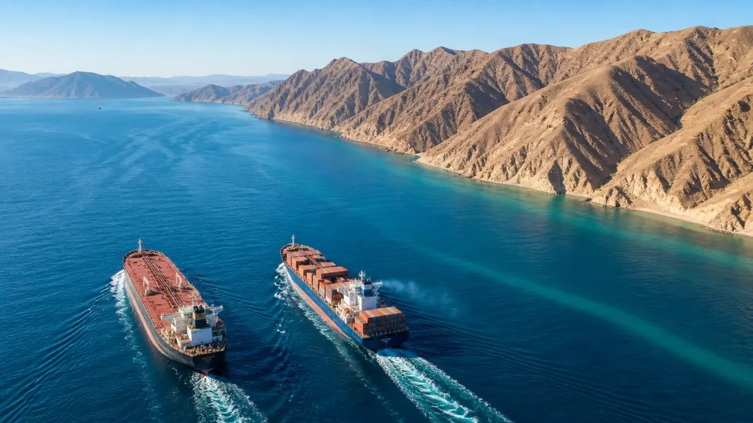
The Strait of Hormuz is the narrow sea passage between Iran and Oman that connects the Persian Gulf to the Gulf of Oman and the Arabian Sea. It is the only sea route in and out of the Gulf, and in a normal year oil equal to about a fifth of the world's consumption passes through it.
Since the conflict that began on 28 February 2026, it has also been the most watched stretch of water on every ship tracking map. Traffic collapsed in March, recovered for a few weeks in June and fell away again in July. In the first week of September, fewer ships crossed in seven days than used to cross in a single ordinary day.
This guide puts the whole picture in one place: the map, the shipping lanes, who controls the water, what flows through it, how traffic has changed in 2026, and what you can actually see when you follow a ship there. Every traffic figure below comes from a named tracker or agency, because in this strait a number without a source is usually a guess.
What Is the Strait of Hormuz?
The strait is what energy analysts call a chokepoint: a narrow channel on a heavily used sea route, where a disruption affects supply far beyond the region. The EIA's chokepoint analysis shows it as one of the two largest oil transit routes on the planet, alongside the Strait of Malacca.
What sets Hormuz apart is how few ways there are around it. It is the primary export route for oil from Saudi Arabia, the United Arab Emirates, Kuwait, Qatar, Iraq, Bahrain and Iran. According to the International Energy Agency, Saudi Arabia and the UAE have some export routes that avoid the strait, while Iran, Iraq, Kuwait, Qatar and Bahrain rely on it for the vast majority of their oil exports.
The waterway is deep and wide enough to handle the world's largest crude oil tankers, which is why it carries such enormous volumes. A single tanker leaving the Gulf typically carries more than a million barrels of oil, so even a small change in the number of daily crossings shows up quickly in world energy markets.
Strait of Hormuz Map: Where It Is and What Surrounds It
On a map, the strait is the narrow neck of water where the Persian Gulf tightens before opening into the Gulf of Oman. Iran lines the northern shore. The southern shore is the Musandam Peninsula, an exclave of Oman on the Arabian Peninsula.
Iran's port of Bandar Abbas, important both economically and militarily, sits on the northern coast, with the Iranian islands of Qeshm, Hormuz and Hengam nearby. West of the strait lie the Gulf states and their export terminals. East of it, on the Gulf of Oman, sit ports that ships can reach without crossing Hormuz at all, which is why they became the practical alternatives in 2026.
| Place | Country | Why it matters on the map |
|---|---|---|
| Bandar Abbas | Iran | Main Iranian port on the strait, with economic and military weight |
| Qeshm, Hormuz and Hengam | Iran | Iranian islands close to Bandar Abbas |
| Musandam Peninsula | Oman | Omani exclave forming the southern shore |
| Ras Al Khaimah | UAE | Coast where false straight-line ship tracks appeared in March 2026 |
| Khor Fakkan and Fujairah | UAE | Gulf of Oman ports outside the strait |
| Sohar | Oman | Gulf of Oman port used as an alternative in 2026 |
How Wide Is the Strait of Hormuz?
Encyclopaedia Britannica gives the strait's width as 35 to 60 miles (55 to 95 km). The IEA puts the narrowest point at 29 nautical miles, about 54 km. Across much of that width the water is 60 to 100 metres deep, enough to handle oil tankers.
That combination of width and depth shaped decades of assumptions. Because the channel is wide and deep almost everywhere, it was long assumed that no country could block the whole strait for any prolonged period.
2026 proved that a closure does not need to be physical. Britannica notes that the threat of confrontation alone was enough to divert more than 90 percent of commercial traffic. Shipowners, insurers and crews do not need a barrier across the water; a credible risk of attack is enough to keep most of them away.
Strait of Hormuz Shipping Lanes
Before the war, ships crossed through a traffic separation scheme: one inbound lane and one outbound lane, each about 2 miles (3 km) wide, separated by a buffer zone of the same width. It works like a divided highway at sea, the same pattern you will find on many of the world's major shipping lanes.
That scheme stopped being the normal route in March. Lloyd's List Intelligence assesses that transits before 13 March used the pre-war lanes, and the picture changed after that.
The Joint Maritime Information Center, which issues security guidance for the region, later assessed the old scheme as unsafe. Oman, coordinating with the International Maritime Organization, activated a temporary traffic regime through Omani territorial waters, with ships leaving the Gulf in phased groups through either a northern corridor controlled by Iran or a southern corridor controlled by Oman.
JMIC guidance issued in June told mariners they could use the southern route by day or night with AIS on, radars running and navigation lights lit. The same guidance warned that mines were still present and that clearance operations were continuing.
Who Controls the Strait of Hormuz?
Nobody owns it outright. According to Encyclopaedia Britannica, the shipping lanes run mostly through Omani territorial waters and partly through Iranian waters, and they are governed by international maritime law under the United Nations Convention on the Law of the Sea. Iran controls the strait north of the lanes, and Oman controls it to the south.
Under that law, ships have a right of transit passage through straits used for international navigation. In July 2026 the IMO Council reaffirmed that this right must not be threatened, impeded, denied, hampered, impaired or suspended.
Law and power are different things here. Iran's coastline, naval bases and military assets sit right beside the lanes, which gives it an advantage no convention removes. International navies have stepped in before to guarantee safe passage, but geography keeps favouring the country on the northern shore.
Oman and Iran have been negotiating over how traffic should be managed, and the outcome may change how much practical control each country holds in the long run.
Iran's Persian Gulf Strait Authority and Transit Rules
On 5 May 2026, Iran announced a new agency, the Persian Gulf Strait Authority (PGSA), which set out its own protocols for crossing the strait and tried to introduce a toll regime. After a memorandum of understanding with the United States in June, Iran warned ships that it would guarantee safe passage only on PGSA routes and under PGSA protocols. Washington objected that the memorandum gave Iran no right to restrict transit.
In late August the PGSA published a blacklist of 45 vessels, mostly tankers, that it accused of breaking its transit rules. Ships on the list face possible fines, detention or confiscation. Lloyd's List Intelligence found that the list includes 12 very large crude carriers responsible for more than 15 percent of crude liftings from the Gulf since the memorandum collapsed in early July.
A proposed Iran-Oman framework would create a temporary traffic separation scheme, sending inbound ships through Iranian waters and outbound ships through Omani waters. Iranian officials have said it is meant to manage commercial traffic, not to restore full freedom of navigation.
Why the Strait of Hormuz Matters for Oil
The IEA estimates that an average of 20 million barrels per day of crude oil and oil products moved through the strait in 2025, around 25 percent of the world's seaborne oil trade. The EIA puts 2024 flows at 20 million barrels per day, equal to about 20 percent of global petroleum liquids consumption.
EIA data shows how Hormuz compares with the other main routes oil takes by sea, in million barrels per day:
| Route | 2022 | 2024 | First half 2025 |
|---|---|---|---|
| Strait of Malacca | 23.0 | 22.5 | 23.2 |
| Strait of Hormuz | 21.9 | 20.7 | 20.9 |
| Cape of Good Hope | 6.1 | 9.3 | 9.1 |
| Suez Canal and SUMED Pipeline | 7.3 | 4.8 | 4.9 |
| Bab el-Mandeb | 8.0 | 4.1 | 4.2 |
Oil loaded inside the Persian Gulf has very few ways out other than through Hormuz, which is why the EIA describes it as the world's most important oil chokepoint even though Malacca carries slightly more. The Cape of Good Hope and Bab el-Mandeb rows show what happens when a route becomes risky and a longer one exists: flows past southern Africa rose in 2024 while Bab el-Mandeb fell by roughly half.
LNG and Other Cargo Through the Strait
Oil is only part of the story. The EIA calculates that 11.4 billion cubic feet per day of liquefied natural gas, more than 20 percent of global LNG trade, moved through the strait in the first half of 2025, mostly from Qatar.
IEA figures show how exposed the two big Gulf LNG exporters are: about 93 percent of Qatar's LNG exports and 96 percent of the UAE's pass through Hormuz. A closure strands those exports.
Bulk carriers matter too. In February 2026, before the conflict, Lloyd's List Intelligence counted 590 bulk carrier transits in the month, alongside 1,667 by tankers and gas carriers.
When traffic collapsed in March, the effects spread well past energy. Britannica reports that prices surged not only for oil and natural gas but for fertilisers and metals such as aluminium, and parts of Asia east of the strait faced immediate fuel shortages that led to extraordinary energy-saving measures.
For importers, that is the practical lesson. Goods that never touch a tanker can still be priced by what happens in Hormuz, through fuel costs, fertiliser supply and the ships pulled into longer, riskier trades.
Has the Strait of Hormuz Ever Been Closed?
Before 2026, never fully. Britannica describes the strait as never truly closed, only disrupted.
The best known disruption was the Tanker War during the Iran-Iraq War. Beginning in 1984, the two countries attacked each other's oil tankers and those of other Gulf states, striking more than 100 tankers. The United States and several western European nations intervened to guarantee safe passage in and out of the Gulf.
The closest call before the current crisis came in June 2025. After US strikes on Iranian nuclear facilities on 22 June, Iran's parliament authorised the armed forces to close the strait. The move needed approval from Iran's Supreme National Security Council, no closure was attempted, and the conflict ended two days later. Even so, some tankers reversed course to avoid the strait.
2026 was different in kind. The strait was never sealed physically, but credible threats and repeated attacks stopped most transit for months, and Britannica calls the result the biggest disruption ever in the global oil supply.
Strait of Hormuz Closure in 2026: A Timeline
The table below follows the main turning points, drawn from Britannica, the IMO and Lloyd's List Intelligence.
| Date | What happened |
|---|---|
| 28 February | Conflict in the Middle East begins |
| March | Iranian threats and attacks, and mines reported by US officials, cut traffic by more than 95 percent |
| Early April | Temporary US-Iran ceasefire, while Iran keeps restricting access |
| 13 April | US Navy begins a blockade aimed at ships moving to and from Iranian ports |
| 4 and 5 May | US-guided transit attempt; two ships pass before it is paused |
| 5 May | Iran creates the Persian Gulf Strait Authority |
| June | US-Iran memorandum lifts the blockade and traffic slowly returns |
| 6 and 7 July | Iran attacks three ships on the Omani coastal route; the US reimposes its blockade |
| Late August | Iran publishes a blacklist of 45 vessels as Iran-Oman corridor talks continue |
| 30 August | US strikes Iranian rocket launchers on the strait, its first military action in weeks |
The June recovery was real but short. Tracking firm AXSMarine counted 25 commercial vessels crossing on one day in mid-June, the busiest since mid-April and more than three times the average of just over seven a day since early March.
Is the Strait of Hormuz Open Right Now?
Open in law, far from open in practice. The Lloyd's List monitor, which counts vessels over 10,000 deadweight tonnes, recorded 75 transits in the week of 31 August to 6 September, down from 116 the week before.
For context, the same monitor counted 3,098 transits in February 2026, an average of about 110 a day. August's total was 486, a fall of 84.3 percent. The strait is passable, but the ships using it are a small, specialised slice of the pre-war fleet.
| Ship type | Transits, 31 Aug to 6 Sep |
|---|---|
| Tankers | 47 |
| Bulk carriers | 16 |
| Gas carriers | 9 |
| Containerships | 1 |
Other vessel types made up the rest. Of the 75 transits, 18 were linked to Iran, meaning the ship was sailing to or from an Iranian port, was owned, managed or flagged in Iran, or was sanctioned. Dark transits, made without a normal AIS signal, accounted for 54.
Treat every weekly number as provisional. Lloyd's List Intelligence updates its figures as dark transits are identified, which is why the week of 24 to 30 August, first shown at 102 transits, was later shown at 116.
Who Is Still Sailing Through the Strait of Hormuz
The traffic that remains is dominated by tankers doing short, repeated runs. Lloyd's List Intelligence describes a shuttle network: tankers move crude between the Gulf and offshore transfer areas, where the cargo passes to other ships. Vortexa data cited in its 27 August brief puts ship-to-ship transfers in the Gulf of Oman at an average of 3.1 million barrels per day since the memorandum collapsed, almost 30 percent of the 5.6 million barrels per day exported from the Gulf over the same period.
That model concentrates risk on a small group of ships and crews. More tankers are joining the trade, particularly Gulf state-owned vessels and ships linked to South Korea's Sinokor, but the southern route is still dangerous. In the week of that brief, a Greek-linked tanker was hit by a projectile in the Omani corridor, the third Greek-linked vessel struck that month.
Container shipping has largely stayed away, with a single containership crossing in the first week of September. Operators are also changing how they crew these voyages: some vessels now use dedicated crews for the Hormuz passage and change personnel once outside the conflict zone, backed by wage premiums and extra welfare measures.
Seafarers Stranded in the Persian Gulf
Behind every transit figure are the people on board. When the conflict began, ships inside the Gulf had no safe way out, and in early April the IMO said around 20,000 civilian seafarers were still aboard vessels there.
An IMO-led evacuation in late June moved 115 ships with roughly 2,500 crew out of the Gulf in three and a half days, according to UN News. It was paused after the container ship Ever Lovely, which was not part of the operation, was struck near the Omani coast.
In its six-month statement on 28 August, the IMO said it had verified at least 70 attacks on international shipping, with 19 seafarers killed, and that up to 400 ships carrying around 6,000 seafarers had been unable to leave safely.
For families, the hardest part is often not knowing where the ship is or whether it is moving. A vessel at anchor inside the Gulf with its AIS on still reports its position, speed and navigation status. Primo Nautic's Loved One Working at Sea tracking purpose turns that raw data into supportive, plain-language updates, including the weather at the ship's location, so you are not left decoding coordinates.
Why Ships Vanish or Jump on a Strait of Hormuz Tracker
Ship trackers rely on AIS, the Automatic Identification System, which broadcasts a vessel's identity and satellite navigation position. If you are new to it, this guide to how AIS vessel tracking works covers the basics. Around Hormuz in 2026, two things undermine it.
The first is ships going dark. Some vessels have turned off their tracking during the war, which is why The New York Times noted that Kpler's crossing counts may not include all activity.
The second is interference with the positions themselves. Pole Star Global tracked 3,396 vessels in and around the strait from 5 March and found 231, roughly one in fifteen, showing suspicious positional anomalies. Satellite communications company Marlink reported that maritime satellite interference rose by 50 percent in March.
A false position usually leaves visible traces:
- Impossible jumps, where a ship moves an implausible distance between two reports
- Straight-line tracks, like the false lines MarineTraffic spotted off Ras Al Khaimah heading toward the strait in March
- Ghosting, where a ship disappears and reappears in a pattern consistent with interference
- Invented identities, such as Jersey Devil 404 and Opium Cargo, reported by Seatrade Maritime in June
- Messages in the destination field, like "China Owner and All Crew", which Pole Star saw ships broadcasting
How to Track Ships in the Strait of Hormuz
The live map around Hormuz is noisy, so follow one ship deliberately rather than scanning the area.
- Search by name, IMO number or MMSI instead of clicking on the map, where spoofed and invented vessels mix with real ones.
- Check when the last position was received. An old timestamp near the strait can mean the ship has gone dark, not that it has stopped.
- Read navigation status and speed together, and look for a track that matches both.
- Compare the reported destination and ETA with the actual track, since around Hormuz the destination field has even carried political messages.
- Judge a single position against the week's transit data rather than on its own.
Primo Nautic lets you search any vessel by name, MMSI or IMO number and follow it with a dual ETA, showing the captain's reported ETA beside an AI-calculated route ETA with a confidence score, plus delay notifications. No AIS app can show a ship whose transponder is off, Primo Nautic included, so a dark vessel stays dark until it transmits again.
What the Strait of Hormuz Crisis Means Beyond the Gulf
The effects reach far past the tankers themselves. Lloyd's List Intelligence describes a trade that has become much more tanker-intensive since July, with extra waiting time, repositioning voyages and ship-to-ship transfers absorbing capacity. Earnings for very large crude carriers have surged to record highs as vessel availability tightens.
Insurance and compliance costs are rising with them. Lloyd's List Intelligence expects elevated war-risk premiums and operational disruption to persist until commercial ships can transit with confidence, while new US sanctions measures have raised compliance risk for owners, brokers and bunker suppliers.
The human side may prove the hardest constraint. Access to qualified seafarers willing to operate in conflict zones may become a major bottleneck, according to the same analysis, and prolonged exposure could deepen the global seafarer shortage.
For anyone following a ship, the practical result is longer routes, more waiting and positions that are harder to trust than they were before February.
Key Takeaways on the Strait of Hormuz
The Strait of Hormuz is the only sea route out of the Persian Gulf, a channel between Iran and Oman whose shipping lanes lie mostly in Omani waters under international law. In a normal year it carries around 20 million barrels of oil a day and more than a fifth of global LNG trade.
In 2026 the threat of attack did what geography was supposed to prevent, cutting traffic by more than 95 percent in March. A brief recovery after the June memorandum ended in July, and by early September weekly transits were a small fraction of February's pace, most of them tankers and many of them dark.
Control is contested in practice. Iran's strait authority, its blacklist and the Iran-Oman corridor talks will shape how ships cross next, while thousands of seafarers remain inside the Gulf. On any tracker, a position near Hormuz deserves a second look before you trust it.