Plimsoll Line Markings: How Ships Know Their Safe Load
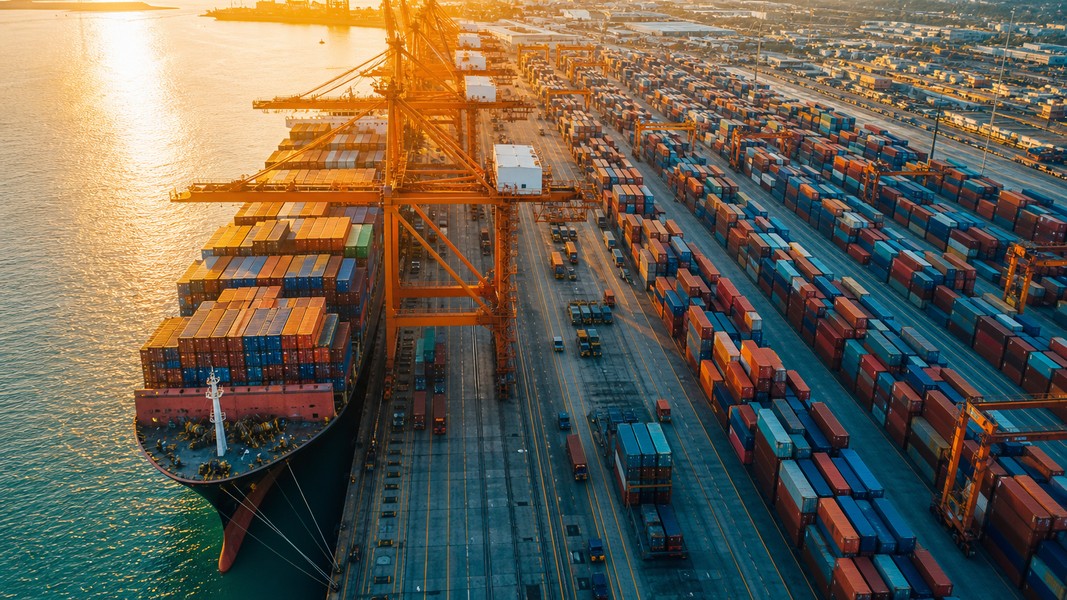
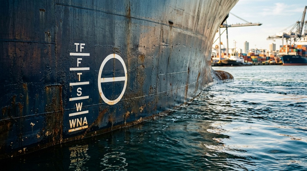
If you have ever stood at a dock and looked at the side of a large cargo ship or tanker, you may have noticed a circle with a horizontal line cut through it, surrounded by a set of letters and lines painted on the hull. That marking is the plimsoll line, and it is one of the most important safety features in maritime history. It tells everyone from the captain to the port inspector exactly how deeply the vessel can sit in the water before it becomes unsafe to sail.
Understanding the plimsoll line markings is not just for mariners. Anyone tracking a ship, planning to travel by sea, or simply curious about how global shipping works will find it useful context.
What Is the Plimsoll Line?
The plimsoll line, also called the international load line or Plimsoll mark, is a marking painted amidships (at the midpoint of the ship's length) on both sides of the hull. It shows the maximum draft a vessel is legally allowed when loaded under various conditions. Draft is the vertical distance from the water's surface down to the lowest point of the ship's hull.
The mark was named after Samuel Plimsoll, a British member of parliament and activist who campaigned relentlessly against overloaded and unsafe vessels in the 19th century. Before his campaign, British shipping was plagued by so-called "coffin ships": unseaworthy, overloaded vessels sent to sea by owners who had insured them for more than their value. In 1873 alone, more than 1,000 sailors lost their lives on overloaded British ships. The UK was losing around 700 ships per year to preventable causes.
Plimsoll fought against powerful shipping interests for years, and in 1876 the UK Merchant Shipping Act finally made load line markings a legal requirement for British vessels. The concept quickly spread, and by the 20th century it had become an international standard under the International Maritime Organization.
Understanding the Plimsoll Line Markings
The central element of the mark is a circle, 450mm in diameter, with a horizontal line passing through its center. This line aligns with the ship's summer saltwater load line, which is the standard baseline for most ocean voyages. Branching out from the circle are a series of horizontal lines on the forward side, each labeled with two letters indicating different loading conditions.
Here is what each marking means, listed from the highest position on the hull (least loaded) to the lowest (most loaded):
- WNA (Winter North Atlantic): The most restrictive mark. Ships crossing the North Atlantic between November and March must not be loaded beyond this point. North Atlantic winters bring severe storms, and this mark requires roughly 50% more freeboard than the summer line.
- W (Winter): For temperate seawater in winter conditions. Denser, rougher water allows slightly more loading than in warm climates.
- S (Summer): The standard mark for temperate saltwater in favorable seasons. This is the baseline most ocean-going vessels use for the bulk of their voyages.
- T (Tropical Saltwater): Used in warm tropical seas where water temperature exceeds 30 degrees Celsius. Warmer water is slightly less dense, so it provides a touch less buoyancy, meaning the load limit is marginally lower than winter.
- F (Fresh Water): Fresh water is less dense than saltwater (roughly 1.000 g/cm³ versus 1.025 g/cm³), so it generates less buoyancy. Ships can ride a few inches deeper in fresh water than in salt water before the load limit is reached.
- TF (Tropical Fresh Water): The deepest permissible load line, used for hot freshwater environments such as tropical rivers and equatorial inland waterways. Water here is warm and low-density, so load limits are tightest.
The spacing between marks is not arbitrary. Naval architects calculate each line based on the physics of water density and the expected sea conditions for each zone. A ship loaded to the summer mark in the North Sea will sit at the correct depth for those conditions; the same ship entering the Amazon River in July must offload cargo to rise to the TF line.
Why the Plimsoll Line Matters for Ship Safety
When a ship is overloaded, its freeboard (the height from the waterline to the main deck) decreases. Less freeboard means waves wash over the deck more easily, water can enter through hatches and ventilators, and the ship loses stability in rough conditions. In the worst case, a vessel with inadequate freeboard can capsize or founder without warning.
The introduction of mandatory load lines dramatically reduced maritime deaths. By 1900, global shipping accident rates had fallen significantly compared to the pre-regulation era. The United Kingdom alone saw catastrophic annual losses cut by a large margin within a generation of the law passing.
The risk has not disappeared in the modern era. The 2015 sinking of the El Faro, a container ship that went down with 33 people aboard during Hurricane Joaquin, was partly attributed to the vessel's loading state combined with its age and design. Modern classification societies and port state control officers still inspect load line compliance as a core part of vessel safety checks.
Overloading a ship is also illegal. Under current international law, masters and owners can face substantial fines, vessel detention, and even criminal prosecution for exceeding load line marks.
Load Line Regulations
The modern framework for load line compliance is built on the Load Lines Convention of 1966, updated in 1988 and 2003, and administered by the International Maritime Organization. More than 160 countries have ratified it, covering over 99% of world merchant tonnage.
The convention works alongside SOLAS (Safety of Life at Sea) to form the backbone of international maritime safety law. Under this system, every cargo ship over 24 meters or 150 gross tons must carry a valid Load Line Certificate, issued by the vessel's flag state through an approved classification society such as Lloyd's Register, DNV, or Bureau Veritas.
Certificates must be renewed every five years, with annual endorsement inspections. When a ship arrives at a foreign port, port state control officers may board and verify that the waterline sits at or above the relevant load line mark for local conditions. If it does not, the ship can be detained until cargo is offloaded and the vessel brought into compliance.
Flag states such as Panama, Liberia, and the Marshall Islands issue the majority of load line certificates for the world's commercial fleet. The system places responsibility on both the country where the ship is registered and the port authorities who verify compliance on arrival.
Understanding how these measurements connect to gross tonnage and displacement is useful context. If you are new to ship measurements, our guide to gross tonnage covers how ship size is officially calculated and what those numbers actually represent.
Plimsoll Line and Modern Vessel Monitoring
Today's ship tracking systems give anyone with a smartphone access to data that once required a port inspector standing dockside. AIS (Automatic Identification System) transponders broadcast a vessel's position, speed, course, and reported draft in real time, allowing remote verification of whether a ship's waterline is consistent with its declared load.
When a vessel transmits a draft of 12 meters and its plimsoll markings indicate a summer limit of 11.5 meters, that discrepancy is visible to anyone monitoring the vessel through a tracking platform. The 2021 grounding of the Ever Given in the Suez Canal drew global attention, and post-incident analysis of AIS data showed the vessel was fully loaded to near its tropical freshwater limit while transiting a relatively shallow waterway.
Apps like Primo Nautic pull live AIS data and present it in plain language alongside weather and sea state information at the vessel's exact location. For someone tracking a cargo shipment or following a working seafarer, this means you can see not just where a ship is but what conditions it is sailing through, combining the plimsoll line's principle of load-appropriate safety with real-time monitoring. For a deeper look at how that data works, our overview of AIS tracking explains how ships are found and followed at sea.
Ship enthusiasts using Primo Nautic can cross-reference a vessel's reported draft against its type and size to get a sense of how heavily loaded it is. A fully loaded Panamax bulk carrier riding low in the water near its summer mark looks very different from the same ship traveling in ballast.
Conclusion
The plimsoll line is a straightforward but powerful concept: a set of marks that encode decades of maritime law, physics, and hard-won safety knowledge directly onto a ship's hull. Each letter represents a specific combination of water type, temperature, and seasonal conditions that determines how much a vessel can safely carry.
From Samuel Plimsoll's 19th-century campaign against coffin ships to today's satellite-connected AIS monitoring, the core principle has not changed. Load a ship beyond what the water can safely hold, and the sea will not forgive the mistake. The markings on the hull exist to make that calculation visible, verifiable, and enforceable at every port in the world.
Most Recent Posts
Discover more articles from our blog.