


Marine Weather Forecast: Reading Sea Conditions Explained
A marine weather forecast describes sea conditions in terms of wind speed, wave height, swell period, and visibility. Unlike a standard weather app that tells you temperature and rain chance, a marine forecast is written for mariners. It uses knots instead of miles per hour, reports wave height separately from swell, and flags hazards like gale warnings that don't appear in land-based forecasts.
If you've ever pulled up a marine weather forecast while tracking a ship and felt like you were reading a different language, you're not alone. These bulletins are written for professional captains and pilots who already know the terminology. For everyone else, including families following a loved one on a cruise, people monitoring cargo shipments, and ship enthusiasts checking live vessel data, the jargon gets in the way.
This guide breaks down every key element of a marine weather forecast in plain terms.
Why Marine Weather Forecasts Feel Like a Foreign Language
Marine forecasts come from agencies like NOAA's weather service and are structured around geographic zones rather than cities. A zone like "Coastal Waters from Sandy Hook NJ to Fire Island NY out 20 NM" describes a specific stretch of offshore water, not a town or airport.
Each forecast zone includes a synopsis (the big-picture weather system affecting a wider region) followed by period-by-period breakdowns: Tonight, Wednesday, Wednesday Night, and so on. Inside each period, you get wind direction and speed, overall sea height, swell details, visibility, and any active warnings.
The problem is density. A single line can pack in four concepts at once:
"SW wind 5 to 10 kt. Seas 3 to 4 ft. Wave detail: NW 3 ft at 8 seconds and SW 2 ft at 18 seconds. Patchy dense fog."
If you know what each part means, this reads instantly. If you don't, it's overwhelming. The sections below decode each element.
Marine Weather Forecast: The Key Components
Every NOAA marine zone forecast includes the same core elements, always in roughly the same order.
Wind comes first: compass direction the wind is coming from, then speed in knots. "SW wind 10 to 15 kt" means wind blowing from the southwest at 10 to 15 knots. Knots are the standard speed unit at sea. One knot equals about 1.15 miles per hour, so 15 kt is roughly 17 mph.
Seas describes the overall wave height. "Seas 3 to 5 ft" means the significant wave height is in that range, covering the combined effect of all wave types in the area.
Wave detail appears in many NOAA forecasts and breaks down the individual wave systems contributing to those seas. You'll see something like "NW 3 ft at 8 seconds and SW 2 ft at 15 seconds," which describes two separate wave trains, each with height and period.
Visibility tells you how far you can see in nautical miles. Low visibility entries appear when fog, rain, or haze reduce sight lines significantly.
Warnings and advisories are flagged at the top of the bulletin or within the period when hazardous conditions are expected. These override everything else in terms of urgency.
Wind at Sea: Knots, Beaufort Levels, and Warnings
Wind drives nearly everything else in a marine forecast. It determines wave height, shapes sea state, and triggers the warning thresholds that matter most to a ship's routing team.
The Beaufort scale gives a useful frame for translating wind speeds into real conditions. At Force 1 to 3 (roughly 1 to 10 knots), the sea surface is calm to gently rippled. At Force 4 to 5 (11 to 21 knots), wave crests become more noticeable and small vessels feel real motion. Force 6 to 7 (22 to 33 knots) brings rougher seas, more rolling, and higher seasickness risk. Force 8 and above (34 knots and up) is gale force, where heavy seas and route changes become common.
The warning thresholds to know:
- Small Craft Advisory: sustained winds around 25 to 33 knots, or dangerous seas for small boats
- Gale Warning: gale-force winds of 34 to 47 knots occurring or expected
- Storm Warning: storm-force winds stronger than gale force
If a marine forecast for your ship's route shows a Gale Warning, that signals strong conditions. Modern cruise ships are designed to handle gales, but crews often reduce speed and may adjust the route to keep passengers comfortable.
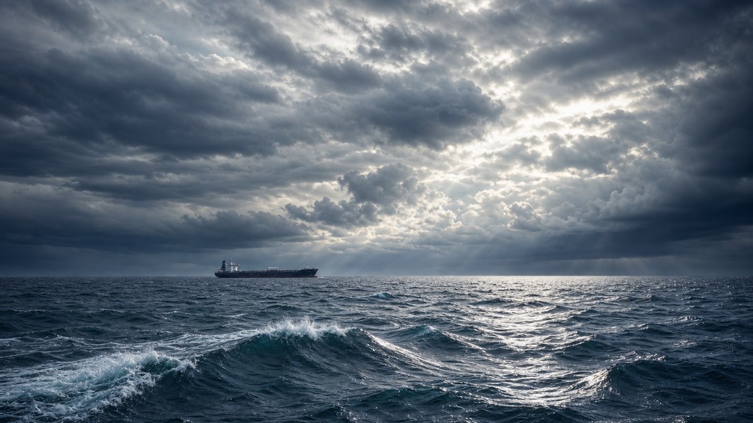
Significant Wave Height and Swell: Two Very Different Things
The "seas" number in a forecast represents significant wave height, which is the average of the highest one-third of waves in an area. It is not the tallest wave, and it's not the average of all waves. Individual waves can run 1.5 to 2 times higher than the significant wave height in certain conditions, so a "seas 5 ft" forecast can still produce occasional waves well above that.
What makes wave detail lines more useful is that they split the sea into separate wave systems: wind waves and swells.
Wind waves are generated by the current local wind. They tend to have shorter periods (3 to 8 seconds between crests) and produce a choppier, more irregular motion. Swells are waves that formed from distant storms and traveled hundreds or thousands of miles. They have longer periods, often 10 to 20 seconds, and create a steadier, more rolling motion even when their height is significant.
Period matters a lot for how a ship feels at sea. A sea state of "3 ft at 6 seconds" is choppier and more uncomfortable than "6 ft at 15 seconds," even though the second example is technically higher. The long-period swell produces a slow, rolling motion that most people tolerate better than rapid short-period chop.
As a rough guide for tracking vessels:
- 1 to 2 ft: calm or slight seas, minimal motion on large ships
- 3 to 5 ft: moderate seas, noticeable movement on cruise ships, more on smaller vessels
- 6 to 8 ft: rough seas, higher chance of discomfort and seasickness
- 9 ft and above: very rough seas, likely speed reductions and possible route changes
Visibility and Fog at Sea
Visibility in marine forecasts is given in nautical miles. One nautical mile equals roughly 1.85 kilometers. When a forecast says "visibility 1 mile or less in rain," it means sight lines are seriously limited in those conditions.
Fog is one of the most operationally significant visibility hazards at sea. A Dense Fog Advisory is typically issued when visibility drops below about 0.5 nautical miles. At that level, even large vessels slow down and rely entirely on radar and AIS data to navigate safely.
When you see "patchy dense fog" in a marine forecast along your tracked ship's route, it doesn't mean the ship is in danger. Modern vessels have radar, redundant navigation systems, and trained bridge teams that handle fog routinely. What it often does mean: expect slower speeds approaching port, possible delays in docking, and very limited deck views from passenger balconies.
Primo Nautic shows live weather conditions at the exact position of any tracked vessel. If a ship you're monitoring is sitting in a zone with reduced visibility, that context appears alongside the position data rather than requiring a separate visit to a forecast bulletin.
How Bad Weather Changes Ship Speed and Arrival Times
Ships don't maintain constant speed in rough conditions. When winds rise and seas build, captains reduce speed to limit hull stress, protect cargo, and improve passenger comfort. In significantly rough seas, large vessels commonly slow by 20 to 40 percent compared to their normal cruising speed. That reduction compounds across a multi-day voyage and is a primary reason real-time vessel tracking becomes especially useful when weather is active.
Route changes happen too. When a marine forecast shows gale or storm-force warnings over a zone, routing services and ship captains work around those areas, choosing tracks that keep dangerous seas at safer angles relative to the hull. A straight line on a map between two ports may curve significantly around active weather.
The combination of speed reduction and route deviation shifts ETAs. A ship that encounters a strong front mid-Atlantic may arrive hours later than the original schedule, even if the sea conditions themselves were never truly extreme by maritime standards.
Primo Nautic's dual ETA system accounts for this. It shows both the captain's reported arrival estimate and an AI-calculated estimate based on current position and route, with a confidence score for each. When those two numbers diverge, it often signals that conditions at sea are influencing speed.
How to Read a Marine Forecast Line by Line
Here's a realistic example NOAA zone forecast entry, the kind you'd find for major shipping routes along the US coast:
Tonight SW wind 5 to 10 kt. Seas 3 to 4 ft. Wave detail: NW 3 ft at 8 seconds and SW 2 ft at 18 seconds. Patchy dense fog.
Breaking it down:
"SW wind 5 to 10 kt" means light wind from the southwest, roughly 6 to 12 mph. Comfortable conditions for any vessel.
"Seas 3 to 4 ft" is the significant wave height. Moderate but not rough, noticeable on a small boat and manageable on a cruise ship.
"Wave detail: NW 3 ft at 8 seconds and SW 2 ft at 18 seconds" describes two wave systems arriving from different directions. The NW waves are shorter-period and choppier; the SW swell is long-period and rolling. The combined effect is moderate, irregular motion.
"Patchy dense fog" is the critical line for ship operations. Low visibility in these areas means reduced speed near port, possible delays, and reliance on electronic navigation.
For the following periods, you read the same structure and look for trends. Are winds climbing into warning thresholds? Are seas building? Is fog expected to persist through the arrival window? Those trends tell you far more than any single period in isolation.
Official marine forecasts for US waters are published by NOAA at weather.gov, organized by marine zone. Each zone has its own page with the full period-by-period bulletin, plus an extended outlook for several days ahead.
What to Focus on When Tracking a Ship
When you look at a marine forecast alongside a tracked vessel, the most useful information is usually:
- Wind speed and whether it crosses warning thresholds (25 kt, 34 kt, 48 kt)
- Seas height and whether conditions are building or easing
- Swell period, which tells you whether the motion will be choppy or rolling
- Any fog or visibility advisories near the ship's current or upcoming position
You don't need to master every element of a marine bulletin to understand what someone at sea is experiencing. Wind, wave height, and any active warnings cover most of what matters.
Marine forecasts become much more readable once you know that "kt" means knots, that "seas" refers to significant wave height rather than the tallest wave, that swells and wind waves are different things, and that period in seconds shapes comfort as much as height does.
Conclusion
Marine weather forecasts pack a lot of information into a dense format designed for professionals. The core elements are always the same: wind speed in knots, seas in feet, swell height and period, visibility in nautical miles, and any active warnings. Once you recognize those building blocks, a forecast that looked impenetrable becomes a clear picture of conditions at sea.
The Beaufort scale anchors wind speed to practical descriptions. Significant wave height is the average of the highest one-third of waves, not the maximum. Swell period matters as much as height for how motion actually feels. And fog, while not dangerous to a properly equipped modern vessel, reliably causes delays near port.
Next time a marine forecast appears in a tracking app or on a weather page, you'll know exactly what each line is telling you.
Most Recent Posts
Discover more articles from our blog.