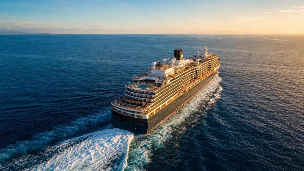
Cruise Ship GPS Tracker: 7 Myths Debunked
Search for a cruise ship GPS tracker and you'll find dozens of apps and maps claiming to show your ship in real time. But most of what people believe about how these trackers work is wrong, and those misconceptions lead to real frustration when a ship "disappears," an ETA looks off, or a tracking app doesn't behave like a live video feed.
The biggest misunderstanding: cruise ships aren't tracked via GPS, at least not in the way you're thinking. The public maps you see rely on a completely different system, and understanding the difference explains most of the confusion around tracking accuracy, update speed, and why ships sometimes vanish from the map.
Here are seven myths worth clearing up before you rely on any cruise tracking tool.
Myth 1: Cruise Ship GPS Trackers Use GPS
This is the most common mix-up, and it shapes everything else.
GPS is navigation, not broadcasting. When a cruise ship uses GPS, it's figuring out where the ship is. That information stays on the bridge. The captain and navigation team use it internally to steer the vessel, but that GPS signal doesn't go anywhere you can access from your phone or computer.
What public trackers actually display comes from the Automatic Identification System, or AIS. AIS is a separate technology that ships use to broadcast their position, speed, course, and identity over VHF radio. These signals are picked up by nearby ships, shore stations, and satellites, then aggregated into the maps you see online. You can read more about how AIS works and why it became the backbone of modern vessel tracking.
GPS is the input feeding the ship's onboard navigation; AIS is the public broadcast that trackers display. They're connected but completely separate systems. The ship uses GPS to know where it is, then AIS to tell the world.
So when you open a cruise ship GPS tracker app, you're looking at AIS data that was broadcast by the ship and collected by a network of receivers. No one is tapping directly into the ship's navigation computers.
The practical implication: "cruise ship GPS tracker" is a widely used phrase, but a more accurate description would be "cruise ship AIS tracker." The terms have become interchangeable in everyday language even though they describe different things.
Myth 2: Live Updates Happen Every Second
"Live" is a marketing word, and it doesn't always mean what it implies.
AIS Class A transponders, the type cruise ships are required to carry, do send position reports frequently. When a vessel is underway, those reports go out every two to ten seconds depending on speed. When anchored, updates drop to every three minutes. That sounds fast, but those are the transmission rates from the ship, not the refresh rate you see in an app.
By the time a signal travels from the ship to a receiver, gets routed through a data aggregation network, and appears on your screen, delays have stacked up. Shore-based commercial AIS networks typically refresh position data roughly every three minutes. Satellite AIS, which covers open ocean areas where shore stations can't reach, adds more latency because the signal has to travel to orbit and back before it reaches the tracking platform.
What "live" actually means in most free apps is roughly 3-10 minutes behind the ship's real position. Premium services with satellite AIS and faster data pipelines get closer to real time, but even the most capable tools show a position that's at least a few minutes old.
This matters if you're watching for a specific moment: when the ship departs port, when it passes a landmark, when it arrives at the next destination. The tracker will show all of those events, just not the instant they happen. Setting realistic expectations makes the experience much less frustrating.
Myth 3: If the Ship Disappears, Something Is Wrong
This one causes unnecessary panic. A ship vanishing from a tracking map is usually a technical event, not a safety emergency.
There are several reasons a cruise ship might stop appearing on tracking tools, and most of them are mundane. The most common is simple coverage. Shore-based AIS receivers only reach so far from coastlines. In open ocean stretches, ships depend on satellite AIS networks, which have gaps. If a ship is between satellite passes and out of terrestrial range, no recent data arrives, and the map shows the last known position frozen in place.
Ships can also legally stop transmitting AIS in certain circumstances. Security concerns in specific corridors, port authority instructions, and other operational reasons can result in a ship going dark temporarily. This practice has been documented in commercial shipping in geopolitically sensitive areas, and while it's less common for cruise ships on established routes, it does happen.
What a disappearance in your tracking app usually means is one of three things: no receiver picked up the ship's latest signal, the tracking platform hasn't processed the most recent report yet, or the ship is in a genuine coverage gap. None of those scenarios mean the ship is in trouble.
Cruise ships on major routes are closely monitored by maritime authorities, coast guard networks, and the cruise lines themselves. A tracking app losing a signal is not the same as the world losing track of a vessel. If you don't see your ship for a few hours, check back later rather than assuming the worst.
Myth 4: Cruise Line Apps Show the Same Data as Third-Party Trackers
When families search for a cruise ship location tracker, they sometimes wonder whether the cruise line's own app is more reliable than an independent one. The answer depends on what you're actually looking for.
Cruise line apps, whether from Royal Caribbean, MSC, Carnival, or others, are built for the onboard experience. Dining reservations, activity schedules, onboard messaging, excursion booking: that's the point. When these apps do show ship position or schedule information, it's typically based on the company's internal operational data, not a live AIS feed from an independent network.
The ETA data is where this gap shows up most clearly. A cruise line app might display a schedule-based arrival time at the next port, reflecting what the operations team has planned. A third-party tracker, by contrast, calculates ETA from the ship's current AIS speed, course, and remaining distance. Those two numbers can diverge, especially if the ship has adjusted its pace mid-voyage.
Live cruise ship trackers that run on independent AIS data can be more current for moment-to-moment position, while cruise line apps may have better information about scheduled port times. They're complementary tools, not direct substitutes.
Primo Nautic bridges this gap by combining live AIS tracking with AI-generated context about what the data means. Rather than showing raw coordinates, it translates position, speed, and weather data into updates adapted to why you're tracking, whether that's following a loved one on a cruise or monitoring a cargo shipment.
Myth 5: All Cruise Ships Are Always Visible
It would be convenient if every cruise ship were visible on every map at all times. Coverage doesn't work that way.
The International Maritime Organization requires AIS carriage on all passenger ships under SOLAS conventions, as well as cargo ships of 300 gross tonnage and above on international voyages. Cruise ships easily meet those thresholds, so they all carry AIS transponders by rule. But "required to carry AIS" is not the same as "always visible on a free tracking map."
Visibility depends on receiver density and satellite coverage. In the Caribbean, Mediterranean, Baltic, and Alaska cruise corridors, terrestrial AIS coverage is dense and reliable. Ships in those regions typically show up with minimal interruption. In the middle of the Pacific or Atlantic, terrestrial coverage drops off completely, and visibility depends on satellite AIS networks with their own coverage patterns and latency.
A ship following a transatlantic itinerary might appear clearly as it departs Europe, become sparse in the open ocean stretch, and reappear with better detail as it nears the Americas. The ship hasn't done anything unusual; it's just moved through varying quality of coverage.
Free apps that rely primarily on terrestrial AIS will show more gaps than platforms that layer in satellite data. This is one of the genuine differences between free and paid tracking tiers.
Myth 6: AIS Data Is Always Accurate
AIS is reliable enough for tracking purposes, but it is not infallible.
The system depends on ships broadcasting their own information over maritime radio frequencies. If a ship's transponder is misconfigured, broadcasting stale data, or transmitting incorrect coordinates, the tracker displays exactly that. There have been documented cases of AIS position spoofing, where vessels broadcast falsified locations, particularly in regions with geopolitical or sanctions-related sensitivities.
For ordinary cruise tracking on established routes, these problems are rare. Major cruise lines operate well-maintained vessels with properly functioning equipment. What you're more likely to encounter is normal data lag rather than bad data: a position that's a few minutes old, a course that reflects the last transmitted heading rather than the current moment-to-moment direction.
Treat tracking data as directional, not absolute. If Primo Nautic shows a cruise ship 20 miles from port and moving at 18 knots, that's a solid indication the ship is close and on schedule. It doesn't mean the ship is at that exact coordinate at this exact second, and small discrepancies between apps are common because each platform processes and displays AIS feeds slightly differently.
The underlying AIS data from the ship is generally honest. The variation comes from when each platform last received and processed the signal.
Myth 7: You Need to Pay for Accurate Cruise Ship Tracking
Most families tracking a loved one on a cruise don't need a paid subscription to get genuinely useful information.
Free tiers on major tracking platforms can show approximate live position, ship name, course, speed, and estimated destination when the vessel is in coverage. For a family monitoring a one-week Caribbean cruise, free access typically covers everything they need: confirming the ship departed, watching it approach the next port, getting a rough sense of ETA.
Where paid tools add real value is in specific scenarios. Open ocean crossings with long gaps between coastal ports benefit most from satellite AIS coverage that free tiers may not include. Faster data pipelines matter if you need to track a precise arrival for a pickup or meeting. Historical track playback is useful for reviewing a voyage after it's complete.
Primo Nautic's free plan includes 100 tracking credits per month, enough to follow a single voyage in reasonable detail without upgrading. The AI-powered insights that translate AIS position and weather data into plain-language updates tailored to your tracking purpose are available on the free plan as well.
Before committing to any paid tool, run the free tier through one voyage and see whether the gaps you encounter are ones that actually matter to you. For most casual tracking, they won't be.
What the Research Shows
Most misunderstanding about cruise ship GPS trackers starts with the name. GPS implies a direct feed from the ship's navigation system, which raises expectations that the underlying technology can't meet.
What public tracking actually provides is AIS data: collected, processed, and displayed with some delay, gaps in open ocean, and occasional inaccuracies baked in by the nature of self-reported broadcasts. That doesn't make it less useful. Knowing a ship's approximate position, course, and ETA answers most of what families and travelers want to understand.
The seven myths above all trace back to the same root: public cruise tracking is a best-effort data system, not a precision instrument. Used with that understanding, it's genuinely valuable. Used with wrong expectations, it produces unnecessary confusion and anxiety that the technology simply isn't responsible for.
Most Recent Posts
Discover more articles from our blog.