


Clouds
Clouds in general

Visible clusters of droplets or frozen crystals floating in the atmosphere are freely called hydrometeor or cloud. A cloud can be formed from a sufficient amount of water vapor, the appropriate number and quality of the ice (condensational) cores; and it requires a process that still allows the formation of droplets or crystals. The clouds can be divided into several types: according to formation, height, form, and into special types.
High Level Clouds
High-level clouds form above 6,000 meters (20,000 feet) and are primarily composed of ice crystals due to the low temperatures at such high elevations.
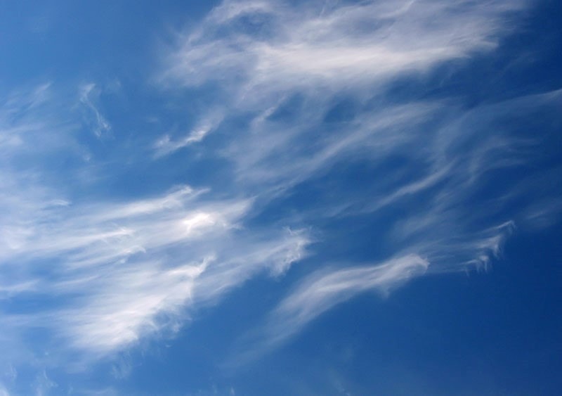
Cirrus (Ci) - by the formation, they belong to the stable type of clouds. Cirrus clouds are fluffy, fleecy, icy clouds with a silky white glow. Cloudy threads can look different - they are sometimes irregular, sometimes straight, sometimes intricately entwined. During the sunrise, these clouds are yellow, during the sunset they become orange, then burgundy, until they finally become completely gray. Such clouds mostly come from the West, or they appear in the clear sky, and then completely disappear. Their most significant role is in predicting wind and the weather in general. Cirrus clouds do not cause precipitation, but they are a sign of bad weather (which occur for a day or two). Calm cirrus clouds are clouds indicating stable, nice weather. On the other hand, cirrus clouds that are moving fast announce bad weather.
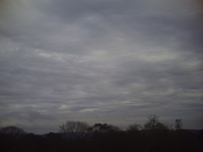
Cirrostratus (Cs) - these are the clouds that appear after cirrus clouds and float 1 km lower than cirrus clouds. Cirrostratus clouds are iced, airy clouds which resemble milky white, undivided cloudy veil. They cover the whole sky, or the part of it, and since they are very thin, a halo appears on them (circle around the Moon or around the Sun). They make up a set of optical phenomena that appear in the form of arch, cross, ring, or light-points which are often called fake Sun. Cirrostratus clouds announce the upcoming bad weather.
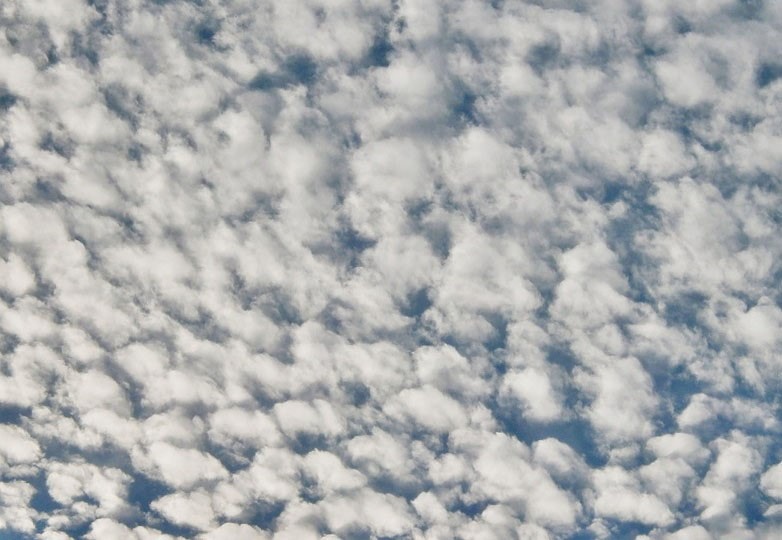
Cirrocumulus (Cc) - given that they always appear together with cirrus and cirrostratus clouds, it is considered that they arise from their degeneration. These are small icy clouds, similar to "sheep" and are composed of tiny white spots which give the impression that the sky is covered with lace. They are arranged in groups, or in more or less regular stripes. There have holes among white clumps, through which you can see blue sky, so it seems like a net. These clouds do not cause precipitation.
Mid-Level Clouds
Mid-Level clouds are "alto" clouds. Clouds with the prefix "alto" are middle level clouds that have bases between 2000 and 7000 m (6500 to 23,000 ft.).
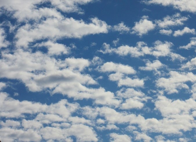
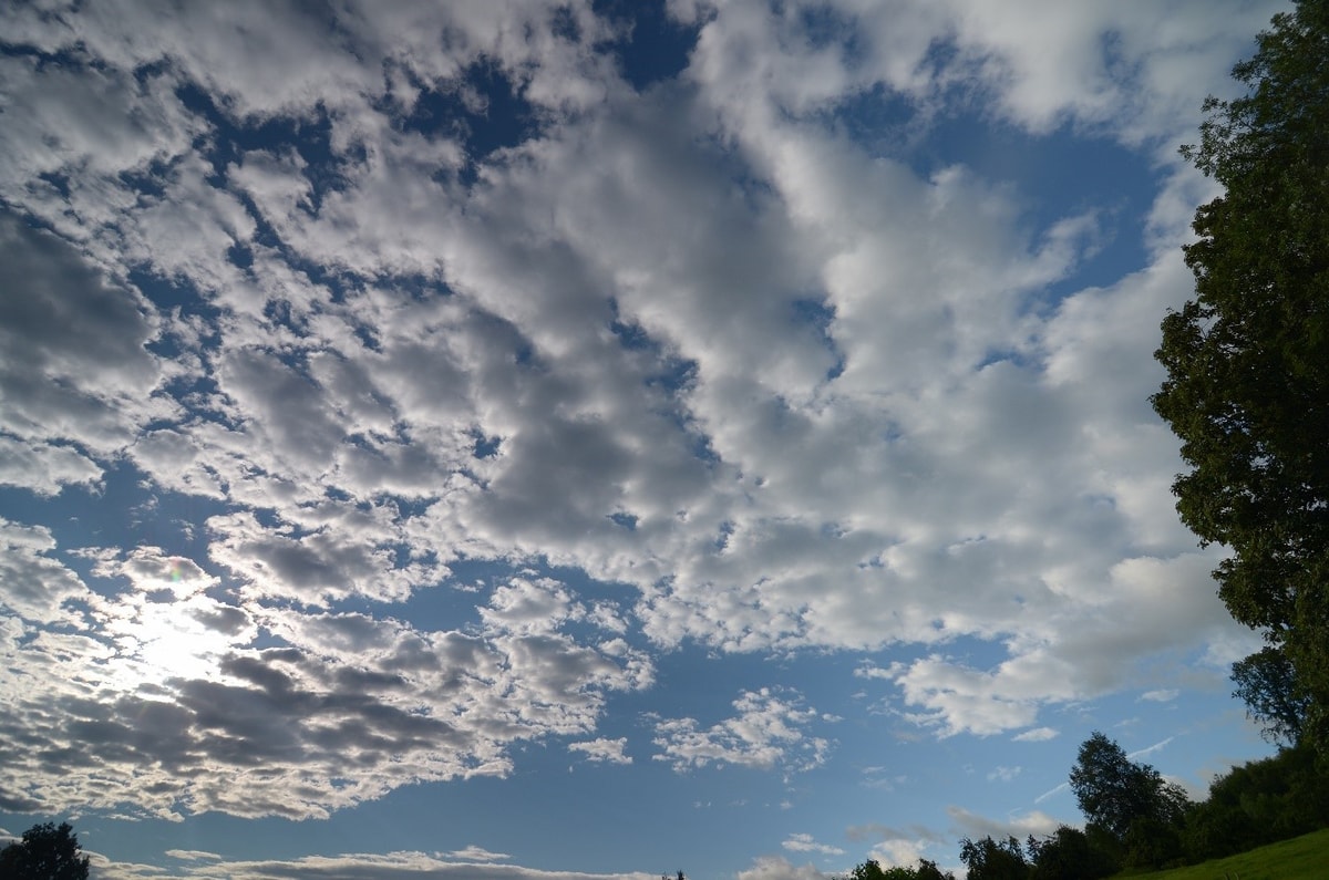
Altocumulus (Ac) - these clouds are formed by local orographic lift of moist air. They are composed of mixture of water and ice. Consequently, they are white or gray, and just the middle parts are thicker and denser, so they look darker. They look like pretty chunky "sheep", they are either round or cylindrical. Their arrangement is mainly regular, and they are substantially wider than cirrocumulus. These clouds also cause no precipitation.
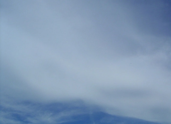
Altostratus (As) - these clouds are composed of mixture of water and ice. They completely or partially cover the sky as an even layer or slightly stripped and uniform layer. Altostratus clouds are thick so they completely cover the Sun and do not cause a halo phenomenon. Altostratus clouds, in summer, cause slight rain, because sometimes it happens that such precipitation evaporates before it gets to the ground. In that case, only the gray strands that hang below the clouds remain. In winter, they cause snow.
Low-Level Clouds
Low-level clouds generally consist of water droplets. However, at very cold temperatures they can also contain ice particles and snow.
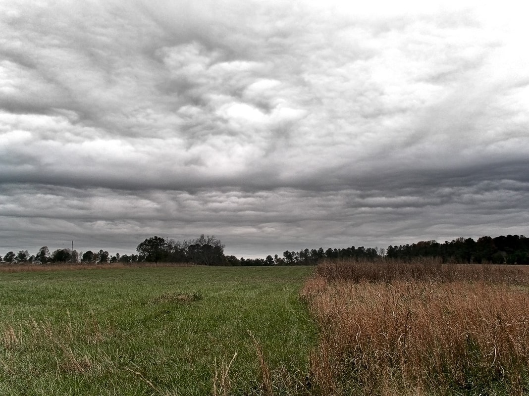
Nimbostratus (Ns) - fluffy clouds composed of water and ice, which completely cover the Sun as a fully compressed monochrome, gray or dark gray layer. Below that layer, mainly small fluffy clouds are formed. Nimbostratus clouds give the appearance of a gray sky and cause rainfall. If they cause precipitation, it is always rain or snow.
Stratocumulus (Sc) - clouds of gray and white lumpy-layered shapes composed of water droplets, and their basis is always dark. Typically, they are cylindrically or lumpy shaped clouds, or the irregular shaped panels whose appearance remind of gravel. When there are more such clouds, they seem like a dense gray mass divided into unequal and irregular pieces. They can appear at any time of the day, whether above the sea or over land, but they do not cause precipitation.
Stratus (St) - these clouds occur more often at night than during the day, and in the cold time of the year. They are called high fog, because they look like a dull thin gray curtain, similar to fog, except that they hover at a height of several hundred meters, rather than lie on the ground. They consist of tiny water droplets mixed with big drops. Stratus clouds cause only small rain (drizzle). Stratus clouds on the ground is called fog.
Vertical Clouds
Clouds with vertical development start in the low section of the atmosphere and travel all the way up through the higher section.
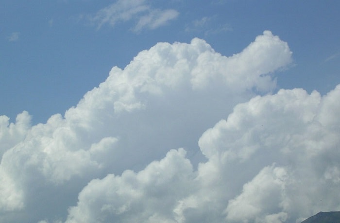
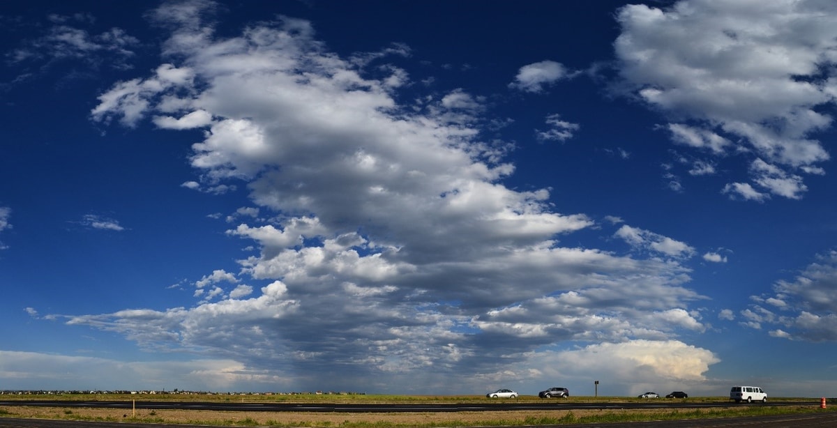
Cumulus (Cu) - these are the clouds which are composed of water droplets, they are ripped and chunky, and they appear in chunky or sharp shapes so they seem swelled. They rise very high, so they can be compared with the giant cauliflower. Cumulus clouds belong to the most beautiful clouds, because parts of the cloud illuminated by the Sun are glittering and white, while the horizontal basis in the shadow is dark. They are not formed nor retained over the sea surface. They can serve as orientation when approaching the coast from the open sea.
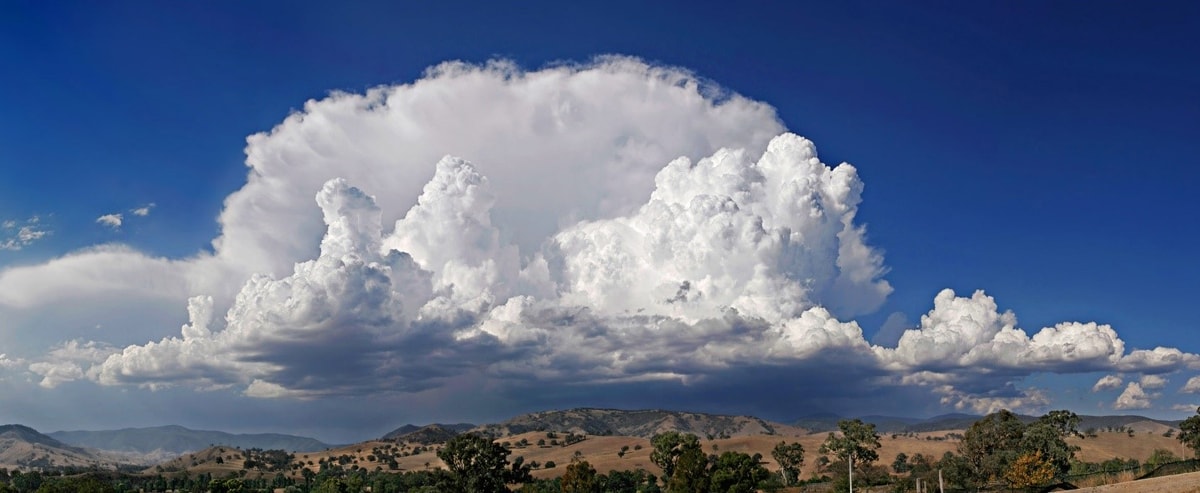
Cumulonimbus clouds (Cb) - these clouds are thick and heavy water clouds which are carried high by powerful upward air currents, so their upper part often freezes. When the upper part freezes, they become storm clouds. The upper part of cumulonimbus is usually similar to a crest because it is flattened and can be stripped or fibrous. As storm clouds, they cause snow or showers of rain, accompanied by thunderstorms and lightnings.
Special Types of Clouds
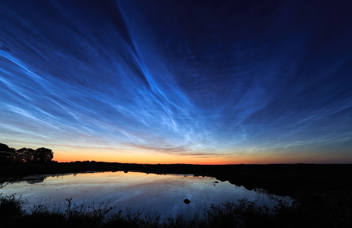
Luminous night clouds - these clouds mostly resemble cirrus and cirrostratus clouds, and they can be seen when the Sun illuminates them below the horizon. They are located in the mesosphere, which means that they are located in heights from 75 to 90 km. It is believed that they are composed of volcanic ash, ice crystals and meteoritic dust. They are mostly perceived in the northern areas.
Nacreous clouds - they are rarely seen in some areas (in winter over the Alaska and in Northern Europe). They are composed of cold droplets and spherical ice particles which occur mainly during the winter when temperatures in the stratosphere fall below the freezing point.
Traces of condensation - they arise behind the aircraft when the atmosphere is cold enough for the flight height.
Fire clouds - also known as a flammagenitus or a pyrocumulus, is a dense cumuliform cloud affiliated with fire or volcanic eruptions that can produce dry lightning (lightning without rain).