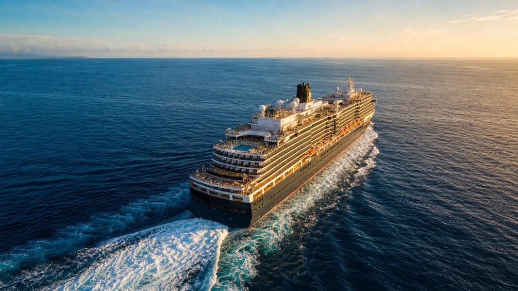
Yacht Tracker: Best Apps to Track Yachts Live
The best yacht tracker apps pull live AIS data to show any vessel's position, speed, and heading on an interactive map in real time. Whether you own a boat and want to check its location remotely, or you're following a celebrity mega yacht for fun, the right app makes all the difference.
This guide ranks the top yacht tracker apps available today and explains exactly what to look for before downloading one.
Why People Use a Yacht Tracker
The reasons people track yachts are more varied than you might expect. Yacht owners use tracking apps to monitor their vessel when it's moored somewhere they're not, getting alerts if the boat moves unexpectedly. Families with loved ones on sailing yachts use trackers for peace of mind, watching progress across ocean passages. Enthusiasts follow luxury and mega yachts to spot billionaire vessels like Jeff Bezos' Koru or track sailing race fleets.
What they all have in common is a reliance on AIS, the Automatic Identification System. Every yacht over a certain size broadcasts its MMSI identifier, position, speed, and course via VHF radio every few seconds. Apps aggregate that data from receiver stations worldwide and display it on a live map. Vessels with Class A transponders (typically required for yachts over 300 gross tonnes) broadcast more frequently; recreational boats with Class B transponders do so less often, but still appear in the same tracking systems.
The main limitation worth knowing upfront: AIS has a VHF radio range of roughly 20 to 40 nautical miles in open water. Satellite AIS networks extend coverage globally, but remote ocean tracking can have delays of several minutes. And if an owner disables the transponder entirely, which some celebrities do to avoid being tracked, the vessel simply disappears from the map.
Our Top Picks at a Glance
| Rank | App | Best For | Platforms |
|---|---|---|---|
| 1 | Primo Nautic | Personal tracking with AI insights | iOS, Android |
| 2 | MarineTraffic | Professional-grade coverage | iOS, Android, Web |
| 3 | VesselFinder | Simple, fast mega yacht lookups | iOS, Android, Web |
| 4 | Boat Beacon | Safety alerts for yacht owners | iOS, Android |
| 5 | Navionics | Route planning and charts | iOS, Android |
| 6 | PredictWind | Weather routing for sailors | iOS, Android, Web |
| 7 | FleetMon | Commercial fleet management | Web, Mobile |
| 8 | NavimetriX | Offshore racing and cruising | iOS, Multi-platform |
How We Evaluated These Apps
Every app in this list was assessed against five core criteria. First, AIS coverage quality: how many vessels appear, how current the data is, and whether satellite AIS supplements ground-based receivers in remote areas. Second, usability on mobile, since most people search for yachts while away from a desktop. Third, relevant features for the two main use cases, which are yacht owners monitoring their vessel and enthusiasts tracking specific ships. Fourth, whether the app contextualizes raw AIS data into something meaningful (weather at the vessel location, estimated arrival, delay alerts). Fifth, the availability and generosity of a free tier.
#1 Primo Nautic: Best for Personalized Yacht Tracking
AIS data by itself is just numbers, and that's exactly what most tracking apps give you. Primo Nautic takes a different approach. It wraps live vessel position, speed, and course inside AI-generated insights that adapt to why you're tracking the boat.
Select "My Own Boat" as your tracking purpose and the app delivers technically precise updates: exact coordinates, speed, heading, and the current weather at your vessel's location. Select "Ship Enthusiast" and it shifts into an educational mode, surfacing interesting facts about the yacht's route, type, and history. That distinction makes Primo Nautic genuinely useful for a wider range of users than competitors who present the same raw table to everyone.
The AI persona system is what separates it from every other app on this list. Six tracking purposes, each with a distinct communication style, means the app doesn't assume you're a maritime professional when you're just following a friend's sailing yacht across the Atlantic.
Other standout features include a dual ETA system that shows both the captain's reported arrival time and an AI-calculated prediction based on current conditions, live weather data at the exact vessel position, and smart notifications for departures, arrivals, and delays.
Primo Nautic is available on iOS and Android with a free tier that covers around 30 vessels per month.
#2 MarineTraffic: Best for Comprehensive Data
MarineTraffic is the industry reference for vessel tracking. Its database covers over 70,000 vessels globally, including the vast majority of yachts large enough to carry AIS transponders, according to MarineTraffic. Search by vessel name, MMSI, or IMO number and you'll typically find what you're looking for within seconds.
The platform excels at historical data. You can replay a yacht's voyage history, see which ports it visited, and track its overall route over weeks or months. For journalists, researchers, or anyone investigating where a specific mega yacht has been, this historical depth is unmatched.
The trade-off is complexity. MarineTraffic was built for maritime professionals and the interface reflects that. Casual users tracking a family member's sailing trip will find the data dense and the presentation clinical. There's no weather at the vessel's location, no AI context, and no adaptation to your reason for tracking. It's a raw AIS feed, very good at what it does, not designed for personal use.
#3 VesselFinder: Best for Quick Mega Yacht Lookups
VesselFinder offers clean, fast access to live AIS data with a free tier generous enough for casual tracking. The mobile app loads quickly, the map is uncluttered, and searching for a specific yacht by name takes a few seconds.
It's the go-to choice for enthusiasts who want to check a celebrity yacht's current position without committing to a full-featured platform. Type in a vessel name, find it on the map, and see its current location, speed, and destination. Simple and effective.
The limitations appear when you want more than coordinates. VesselFinder doesn't contextualize the data: no weather at the yacht's position, no adaptive notifications, no ETA confidence scoring. For a yacht owner who needs real monitoring capabilities, it falls short.
#4 Boat Beacon: Best for Safety-Focused Yacht Owners
Boat Beacon focuses on collision avoidance and proximity alerts rather than general tracking. It shows nearby AIS vessels on a chart overlay, calculates closest-point-of-approach for approaching ships, and sends alerts when other vessels enter a configurable radius.
For yacht owners doing overnight passages or sailing in high-traffic shipping lanes, this is a practical safety companion. It works even without a physical AIS transponder onboard, using the phone's GPS and internet AIS feed to populate the chart with nearby traffic.
The limitation is scope. Boat Beacon is a safety tool first, tracker second. It's not designed for tracking a specific yacht from afar or following a route over time. Remote monitoring of your vessel while you're not on it is not its primary function.
#5 Navionics: Best for Passage Planning
Navionics, now owned by Garmin, combines nautical charts with AIS vessel overlays in a single navigation app. It's the choice for yacht owners who plan routes, use tidal data, and want depth soundings alongside vessel positions.
The charts are Navionics' strength, covering coastal and offshore waters worldwide with community-sourced depth updates. AIS integration means you can see nearby vessel traffic while planning a route through a busy channel or unfamiliar anchorage.
For pure yacht tracking rather than navigation, Navionics is overkill. Its premium tier sits behind a subscription, and if you're not using the charts, you're paying for features you won't touch. As a combined navigation and situational awareness tool for active sailors, it's excellent.
#6 PredictWind: Best for Weather-Conscious Sailors
PredictWind pairs AIS tracking for over 280,000 vessels with high-resolution weather routing and ocean current data. If your reason for tracking a yacht is following a race or monitoring a friend's offshore passage, PredictWind gives you the weather context to understand what conditions they're sailing through.
The app generates optimized routing for ocean passages based on multiple weather models, and the AIS layer shows fleet positions during offshore races. It's particularly popular in the offshore sailing community for following events like the Sydney to Hobart or the Clipper Race.
Pure tracking without weather planning is possible, but PredictWind's value comes from the combination. If you don't care about routing or forecasts, simpler free options like VesselFinder accomplish the same tracking with less friction.
#7 FleetMon: Best for Commercial Yacht Fleet Management
FleetMon targets maritime professionals and enterprise users managing fleets of vessels. Its analytics dashboards, voyage history, and customizable alert systems are powerful, but the platform is built for commercial operators, not personal yacht tracking.
For a charter company managing a fleet of sailing yachts or a high-end yacht management firm overseeing multiple vessels, FleetMon's reporting tools justify the subscription. For anyone tracking a single yacht, it's far more complex than necessary.
#8 NavimetriX: Best for Offshore Racing
NavimetriX is a sailor-designed navigation app that integrates AIS data from AISHub alongside NMEA hardware, GRIB weather routing, tide predictions, and performance analytics. It's built for offshore racers and serious cruisers who want cloud-synced routing alongside live vessel tracking.
The AIS layer pulls from AISHub, one of the largest community-based receiver networks, which gives it good coastal coverage. For a race officer tracking a fleet during an offshore event, or a cruiser wanting to see other vessels in the area, it performs well.
The interface requires familiarity with sailing-specific terminology and concepts. Casual users or those tracking a yacht from shore will find other apps more accessible.
What to Look for in a Yacht Tracker
Before choosing an app, consider four factors that determine whether it will actually work for your use case.
AIS coverage quality matters most. Ground-based AIS receivers cover coastal areas well, but open-ocean passages require satellite AIS relay. Check whether the app uses satellite AIS or only terrestrial data if you're tracking transatlantic or offshore routes.
Contextual data versus raw numbers. Most apps display position, speed, and course. That's useful, but it doesn't tell you whether the yacht is in rough weather, ahead of schedule, or approaching port. Apps like Primo Nautic add weather at the vessel's location and ETA predictions that turn coordinates into meaningful updates, which matters a lot if you're tracking a loved one on a long passage.
Notification systems separate active monitoring apps from passive lookup tools. If you want to know when your boat moves from its mooring or when a vessel arrives at port, you need an app with departure, arrival, and delay alerts rather than one where you have to open the map and check manually.
Privacy implications cut both ways. If you own the yacht, consider that your vessel's AIS position is publicly visible to anyone using a tracking app unless you disable the transponder. For enthusiast tracking of celebrity yachts, note that many owners of high-profile vessels do disable AIS periodically, at which point the vessel disappears from every tracking platform simultaneously.
Understanding AIS Limitations
AIS is a VHF radio system, which means range and obstructions matter. Terrestrial receivers cover roughly 20 to 40 nautical miles line-of-sight, which is adequate for coastal monitoring but creates gaps in the mid-ocean. Satellite AIS extends coverage globally but introduces variable delays, sometimes several minutes behind actual position in remote areas.
Recreational yachts typically carry Class B transponders, which broadcast at lower power and less frequently than the Class A units on commercial ships. This means a small sailing yacht can appear and disappear from the map as it moves in and out of receiver range, particularly in areas with sparse ground station coverage.
Understanding how AIS works helps set realistic expectations for any tracking app. No app can show you a vessel that isn't broadcasting, and all apps are subject to the same physics of VHF signal propagation.
Conclusion
For most personal use cases, whether you're a yacht owner monitoring your boat remotely or an enthusiast following a specific vessel, the combination of live AIS data and contextual insights matters more than raw data volume. Apps like MarineTraffic and VesselFinder offer the broadest coverage; Primo Nautic adds AI-driven personalization and weather context that make the data genuinely useful rather than just accurate. For sailors who want navigation charts alongside tracking, Navionics and PredictWind remain the professional standards.
The right app depends on why you're tracking. Know your use case first, check the AIS coverage for your region, and prioritize apps that turn raw coordinates into information you can actually use.
Most Recent Posts
Discover more articles from our blog.