


Shipping Lanes: World Map and Complete Guide
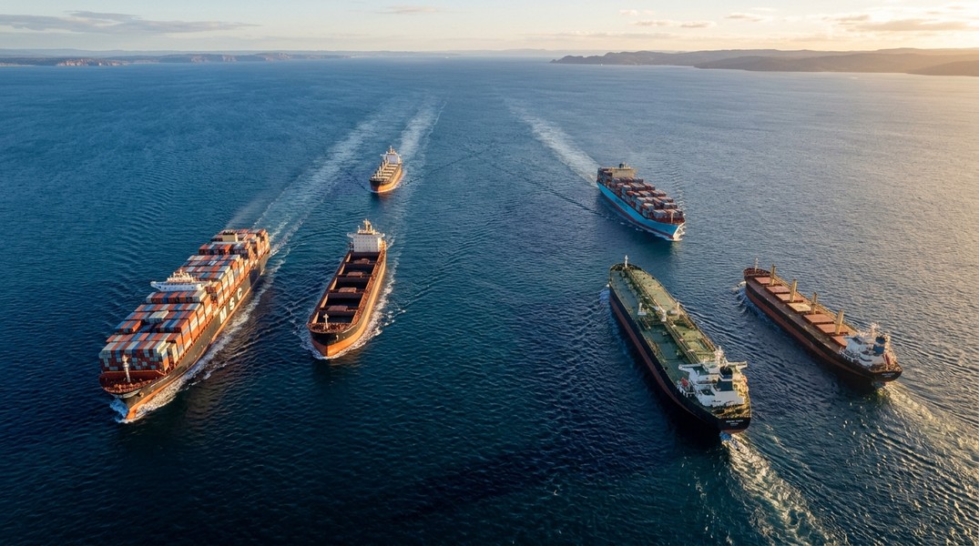
Shipping lanes are designated maritime corridors that channel vessels along established paths across oceans and through strategic chokepoints. Rather than sailing freely across open water, commercial ships follow these organized routes to reduce collision risk, comply with international regulations, and take advantage of the most efficient paths between ports.
The world's shipping lanes carry more than 80% of global trade by volume. From the narrow Strait of Malacca to the vast North Atlantic corridor, these routes are the backbone of the global economy. This guide covers every major shipping lane, how they are regulated, and how you can watch real ships navigate them in real time.
What Are Shipping Lanes?
A shipping lane is a recognized corridor through which maritime traffic concentrates due to geography, regulation, or efficiency. Some are narrow geographical chokepoints where all ships must pass regardless of preference. Others are broad ocean corridors established by convention because they represent the fastest or most fuel-efficient path between major ports.
The concept of organized shipping lanes emerged gradually as international maritime trade grew in the 19th and 20th centuries. The International Maritime Organization formalized the system through Traffic Separation Schemes, which divide opposing traffic streams into one-way lanes with buffer zones between them.
Not all shipping lanes are legally mandatory. Under the United Nations Convention on the Law of the Sea, Traffic Separation Schemes in international waters are internationally recommended rather than strictly enforceable by any single nation. In practice, however, commercial vessels follow established lanes as a matter of safety, insurance compliance, and professional standard. Deviating from established lanes without good reason can void marine insurance coverage and invite regulatory scrutiny at the next port.
Within territorial waters, the rules shift: coastal states can enforce their own maritime regulations, and vessels transiting narrow straits under innocent passage rules must follow established traffic separation schemes.
How Traffic Separation Schemes Work
A Traffic Separation Scheme consists of several defined components. Inbound and outbound traffic lanes run parallel to each other, each carrying vessel traffic in a single direction. Between them sits a separation zone or separation line that ships are prohibited from crossing unnecessarily.
At the ends of these lanes, and at points where traffic from different directions converges, the scheme designates precautionary areas. These are zones where vessels must reduce speed and maintain heightened vigilance because collision risk spikes when traffic streams merge or cross.
The COLREGS framework sets out the rules ships must follow inside Traffic Separation Schemes. Vessels crossing a separation zone must do so at as close to a right angle as possible, minimizing the time spent in the buffer. Vessels proceeding along a lane must travel in the general direction of traffic flow for that lane. Ships that cannot use the main lanes due to their size or draft must use designated deep-water routes or inshore traffic zones, keeping the main lanes clear for larger vessels.
Coastal authorities monitor compliance through automated AIS tracking. If a vessel's position data shows it outside expected corridor boundaries, or if its speed is inconsistent with normal transit, the system flags it for investigation. Penalties for unauthorized deviations range from regulatory fines at the next port to insurance complications that can affect the ship's entire voyage.
The World's Major Shipping Lanes
The ten lanes below together carry the overwhelming majority of global seaborne trade. Understanding their geography and importance provides a foundation for reading live ship traffic data intelligently.
English Channel and Dover Strait
The Dover Strait connects the North Sea to the Atlantic Ocean between the United Kingdom and mainland Europe. At its narrowest point it measures roughly 21 nautical miles across, making it one of the most geographically constrained high-traffic lanes in the world.
More than 400 vessels transit the strait on a busy day, and annual traffic exceeds 120,000 passages across all vessel types. Container ships moving between Northern European ports (Rotterdam, Hamburg, Antwerp) and Atlantic destinations share the lane with tankers, bulk carriers, and ferries. Strong tidal currents and frequent autumn and winter fog make navigation demanding despite the short distance.
The Dover Strait TSS divides eastbound and westbound traffic into separate lanes with a distinct separation zone between them. Ships violating the scheme risk not only collision but also regulatory action from both French and British maritime authorities, who monitor the strait closely.
Strait of Malacca
The Strait of Malacca runs between the Malay Peninsula and the Indonesian island of Sumatra, connecting the Indian Ocean to the South China Sea. At its narrowest point near the southern end, the navigable channel is approximately 1.7 nautical miles wide.
An estimated 25 to 30 percent of global trade passes through this strait, making it the single most important chokepoint in world shipping. The lane serves as the primary pipeline for crude oil and liquefied natural gas flowing from Persian Gulf producers to China, Japan, South Korea, and the rest of Asia. Ultra-large container ships carrying manufactured goods in the opposite direction share the strait with tankers and bulk carriers.
Annual transits exceed 94,000 vessel passages. The combination of narrow geography, high traffic density, shallow waters in some sections, and historical piracy concerns makes the Strait of Malacca one of the most carefully monitored lanes on the planet.
Strait of Hormuz Shipping Lanes
The Strait of Hormuz links the Persian Gulf to the Gulf of Oman, forming the only maritime exit from the Gulf region. It measures roughly 21 nautical miles at its navigable section, with two shipping lanes each about 2 nautical miles wide separated by a 2-nautical-mile buffer.
This strait handles approximately 20 to 25 percent of global petroleum liquids consumption by volume. Every barrel of oil exported from Saudi Arabia, Kuwait, Iraq, the UAE, and Iran that moves by sea must pass through here. That concentration of energy traffic gives the strait enormous geopolitical weight: any disruption would spike global energy prices within days.
Annual vessel transits reach around 21,000 passages, heavily weighted toward very large crude carriers, product tankers, and LNG carriers. The strait's strategic sensitivity means it receives intensive monitoring from multiple national navies and commercial maritime intelligence services.
Suez Canal Route
The Suez Canal connects the Red Sea to the Mediterranean through Egypt, eliminating the need to sail around the Cape of Good Hope at Africa's southern tip. For ships traveling between European ports and Asian or East African destinations, the canal cuts the voyage by roughly 6,000 to 7,000 nautical miles.
The canal handles approximately 12 to 15 percent of global maritime trade, with around 20,000 vessel transits per year. Every vessel transiting must accept a mandatory canal pilot and pay transit fees that range from approximately $100,000 to more than $300,000 depending on ship size and cargo type.
The 2021 grounding of the container ship Ever Given illustrated how dependent global supply chains are on this single corridor. The six-day blockage backed up more than 300 ships and disrupted container schedules across Asia and Europe for weeks. More recently, security concerns in the Red Sea have pushed some shipping companies to reroute around Africa, adding time and cost to every voyage. Visit the Suez Canal Authority for current traffic advisories.
Panama Canal Route
The Panama Canal crosses the Isthmus of Panama, connecting the Atlantic and Pacific oceans. For container ships and bulk carriers moving between East Coast North American ports and Asian destinations, it saves more than 5,000 nautical miles compared to routing around Cape Horn.
Annual transits reach approximately 14,000 vessel passages, representing roughly 5 to 6 percent of global maritime trade. The canal uses a lock system: ships enter locks, water fills or drains to raise or lower the vessel, and the ship proceeds to the next level. Transit typically takes 8 to 10 hours from ocean to ocean.
The 2016 expansion added a new lane of wider locks capable of handling post-Panamax vessels up to about 13,000 TEU in container capacity. Drought conditions in 2023 and 2024 forced the Panama Canal Authority to reduce daily transits and increase fees substantially, showing how vulnerable this critical chokepoint is to climate variability.
Strait of Gibraltar
The Strait of Gibraltar separates Europe from Africa and connects the Mediterranean Sea to the Atlantic Ocean. At its narrowest point near Tarifa, Spain, the strait measures approximately 8.9 nautical miles across.
More than 100,000 vessels transit Gibraltar annually, making it one of the highest-density maritime passages in the world. Container ships connecting Northern European ports to Asian or American destinations use it as the entry or exit point to the Mediterranean. Tankers, bulk carriers, and cruise ships add to the traffic mix.
The strait operates under joint oversight from the United Kingdom (which administers Gibraltar), Spain, and Morocco, creating a complex jurisdictional environment. Strong Atlantic-Mediterranean exchange currents and dense traffic make pilotage and AIS monitoring particularly important here.
Bosporus Strait
The Bosporus, running through Istanbul, Turkey, is the only maritime connection between the Black Sea and the Mediterranean. At its narrowest point it measures just 0.7 nautical miles, making it the tightest major shipping chokepoint in the world.
The strait handles approximately 45,000 vessel transits per year, primarily tankers carrying crude oil and petroleum products from Russian and Caspian producers, bulk carriers loaded with grain from Ukraine and Russia, and LNG carriers. Turkey exercises full sovereignty over the strait and enforces its own maritime traffic regulations in addition to IMO guidelines.
A strong northward-flowing surface current and a countercurrent at depth complicate navigation. The dense urban setting, with Istanbul on both banks, means any collision or grounding has immediate consequences for one of the world's largest cities.
Singapore Strait
The Singapore Strait connects the Strait of Malacca to the South China Sea at the eastern end of the Malacca route. It passes between Malaysia and Singapore, with Singapore port on its northern shore.
Traffic volumes match those of the Strait of Malacca itself, with approximately 94,000 vessel transits annually. On the busiest days, more than 2,000 vessels move through the adjacent waters. Singapore port functions as one of the world's largest transshipment hubs, so the strait concentrates not only through-traffic but also vessels calling at Singapore for container transfers, bunkering, and port services.
The strait requires complex pilotage arrangements for large vessels. Multiple overlapping Traffic Separation Schemes manage the different traffic streams. Given the density, the collision and grounding risk is among the highest of any shipping lane globally.
Great Lakes Shipping Lanes
The Great Lakes system, spanning roughly 750 miles from the western end of Lake Superior to the eastern end of Lake Ontario, forms North America's inland maritime highway. The five lakes, connected by rivers and the St. Mary's River at the critical Soo Locks, carry iron ore, coal, grain, cement, and limestone between the industrial heartland and Atlantic seaports via the Saint Lawrence Seaway.
The system handles around 100 million metric tons of cargo per year across approximately 4,000 seasonal vessel transits. Navigation is limited to roughly April through November before ice closes the connecting channels. The Soo Locks, which raise and lower vessels between Lake Superior and Lakes Huron and Michigan, are a critical chokepoint: a single lock handles the majority of steel and iron ore moving through the system.
Understanding Great Lakes vessel schedules helps anyone tracking bulk carriers or ore boats on this inland system, where ship movements follow consistent seasonal patterns tied to industrial production.
GIUK Gap
The GIUK Gap refers to the broad North Atlantic corridor between Greenland, Iceland, and the United Kingdom. Unlike the narrow straits described above, this is an open-ocean route with no geographic constraint. Ships use it because it represents the natural path between Northern European ports and North American East Coast destinations.
Annual transits exceed 50,000 vessel passages, carrying container ships, tankers, and bulk carriers between the two largest trading blocs in the world. Weather in the North Atlantic is the main challenge: North Atlantic storm systems are among the most severe in any major shipping lane, and winter seas regularly force routing adjustments.
No formal Traffic Separation Scheme governs the GIUK Gap, but IMO-recommended routing guidelines help manage traffic flow. The route's strategic importance extends beyond commerce: it was the critical naval battleground of the Atlantic during World War II and remains significant for maritime security today.
Arctic Shipping Lanes
Two Arctic routes have attracted growing attention as climate change reduces summer sea ice cover in the Arctic Ocean.
Northern Sea Route
The Northern Sea Route runs along Russia's Arctic coast from the Barents Sea to the Bering Strait. Compared to the traditional Suez Canal routing, it can reduce Asia-to-Northern-Europe voyage distances by up to 40 percent on paper.
In practice, the route remains limited. Current annual transits number fewer than 50 full passages, almost entirely Russian state-owned or state-affiliated vessels carrying oil, LNG, and raw materials. The navigation season extends roughly from June to October in favorable years. Outside that window, multi-year ice and extreme cold make the route impractical for standard commercial vessels.
The economics strongly favor liquid bulk cargo. Cost savings of 45 to 50 percent relative to traditional routes are achievable for oil and LNG tankers with icebreaker assistance, which itself costs $100,000 to $500,000 or more per transit. Containerized cargo remains uncompetitive: Arctic-capable container ships max out at around 5,000 TEU, far below the 20,000 TEU vessels that make modern container shipping economical on established routes.
Research projects that Arctic routes will carry only about 3.5 percent of Asia-Europe trade within the next five years, even under optimistic ice-melt scenarios. The overwhelming majority of global shipping will continue using established straits and canals for the foreseeable future.
Northwest Passage
The Northwest Passage threads through the Canadian Arctic Archipelago, connecting the Atlantic and Pacific through a maze of islands and channels. It is theoretically shorter than the NSR for some North America-to-Asia routes but faces more severe ice conditions, particularly multi-year ice that persists even in warm summers.
Canada asserts sovereignty over the passage and requires mandatory icebreaker escort and prior authorization. Fewer than 10 to 15 transits occur annually, almost entirely research vessels, supply ships, and tourist expedition vessels. Commercial freight transit is not expected to become viable before the 2040s, if then.
How to Watch Live Ship Traffic on Shipping Lanes
Every commercial vessel above 300 gross tons is required to operate an AIS transponder continuously. AIS broadcasts the ship's position, speed, heading, vessel type, flag, IMO number, and estimated arrival time at regular intervals. This data is received by coastal stations and aggregated into public tracking platforms.
What you see in real time on a shipping lane map is the cumulative result of thousands of these simultaneous broadcasts. In the Strait of Malacca on any given morning, more than 200 vessels may be simultaneously transmitting position data. In the Dover Strait, the inbound and outbound lanes appear as dense streams of moving dots, each representing a real vessel with a real cargo.
To understand how the underlying technology works, the full explanation of AIS vessel tracking covers the signal types, transmission frequencies, and data fields in detail.
Primo Nautic brings this data together with contextual intelligence. Rather than showing raw position dots, it translates each vessel's AIS data into information adapted to why you are tracking a particular ship. If you are following a cruise ship through the Dover Strait, you see its position relative to the lane boundaries, its current speed, and an AI-generated ETA for the next port. If you are monitoring a cargo shipment approaching the Panama Canal, you see queue depth, estimated lock transit time, and delay alerts if the vessel falls behind its schedule.
The app covers all major shipping lanes globally. Whether a vessel is transiting the Strait of Hormuz, holding position outside the Suez Canal waiting for convoy assignment, or making its way through the Great Lakes locks, Primo Nautic shows its live position and generates updates adapted to your tracking purpose.
For maritime enthusiasts, following a very large crude carrier through the narrow shipping lanes of the Strait of Hormuz offers a concrete way to understand how global energy markets depend on a 21-nautical-mile passage. For families with a loved one working on a cargo ship, watching that ship's live track as it moves through one of these corridors turns an abstract voyage into something you can follow moment by moment.
Conclusion
Shipping lanes compress nearly all of world trade into a handful of critical corridors, many of them strikingly narrow. The Bosporus at 0.7 nautical miles, the Strait of Malacca at 1.7 nautical miles, and the Singapore Strait at 1.5 nautical miles together channel a combined share of global trade that no alternative route could absorb.
Traffic Separation Schemes, COLREGS regulations, and mandatory AIS broadcasting keep these lanes functioning despite their density and complexity. The system works because every commercial vessel participates in it, broadcasting its position and following established rules in waters that would otherwise be ungovernable.
Arctic routes are opening slowly due to climate change but will carry only a small fraction of global trade for years to come. The economic case for the Northern Sea Route applies primarily to liquid bulk cargo; containerized trade will remain on established routes well into the future.
For anyone curious about the real-time choreography of global maritime commerce, AIS tracking tools make these shipping lanes visible in a way that was impossible for most people even a decade ago.
Most Recent Posts
Discover more articles from our blog.