



Marine Traffic Free vs Paid: What Each Plan Includes
Marine Traffic free gives you the live map, vessel search, basic ship and port details, news, photos and a fleet of up to 5 vessels, all fed by coastal AIS stations. What it does not give you is a ship in the middle of the ocean. Satellite positions, voyage ETAs, longer track history and notifications all sit behind the paid plans.
That split matters more than most people expect. A free account works well for watching a ferry cross a strait or a cargo ship waiting outside a port. It works poorly for following a container across the Pacific or a family member on a two week crossing, because the ship simply drops off the map once it leaves coastal range.
This guide breaks down what the free account really includes, what each paid tier adds, and how to decide whether you need to upgrade at all.
Who Runs MarineTraffic Now
MarineTraffic is still the best known name in public ship tracking, but it is no longer an independent company. Kpler completed its acquisition in early 2023, and the platform now sits inside Kpler's wider maritime data business alongside the former FleetMon service.
That ownership shapes the product. Kpler sells commercial intelligence to traders, charterers and ship managers, and its product updates in 2026 focused on risk indicators, historical AIS APIs, container intelligence and a redesigned mobile app. The free account is the entry point to that funnel, not the destination.
According to the official plans page, MarineTraffic serves over 8.5 million monthly users. Most of them never pay, which is why the free tier stays generous on the map itself and tight on everything around it.
What Marine Traffic Free Includes
Creating an account costs nothing, and the plans page lists the free tier for individuals as four things: coastal vessel tracking, basic vessel data, news and photos, and fleet tracking for 5 vessels.
In practice that means you can:
- Search any ship by name, MMSI or IMO number and open its basic profile
- See live positions on the map wherever a shore station picks up the signal
- Browse port pages, ship photos and maritime news
- Save up to 5 vessels to a personal fleet for quick access
For casual use, this covers a lot. If you want to check whether a cruise ship has docked, identify a tanker you can see from the beach, or watch traffic in a busy channel, the free account does the job without friction.
The Free Mobile App
The mobile app follows the same logic. MarineTraffic's own Mobile Pro FAQ says the free version lets you access the map and search for vessels using terrestrial and roaming AIS only, view basic vessel and port details, and track a fleet of up to 5 vessels.
The same page adds a warning worth reading twice: on the free version, some vessel positions may be unavailable or not fully accurate. That is not a bug. It is the direct result of relying on coastal receivers only.
The Coverage Gap in the Free Plan
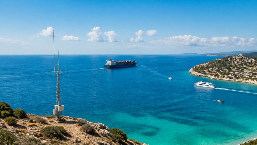
The single biggest difference between free and paid is where the data comes from. Free accounts see positions recorded by MarineTraffic's network of terrestrial AIS stations. Those stations have a hard physical limit.
MarineTraffic's help centre explains that a receiving station with an antenna 15 meters above sea level picks up ships within roughly 15 to 20 nautical miles. Stations on higher ground reach 40 to 60 nautical miles, and the typical AIS range for most of their base stations is about 40 miles. The US agency NOAA describes the same boundary for its own data, noting that coverage is unavailable for waters more than 40 to 50 miles from the coast.
Once a ship sails beyond that band, a free account stops receiving fresh positions. The vessel shows as out of range, and if no new position arrives for 24 hours, MarineTraffic removes it from the live map until it reappears near a coast.
Smaller boats make this worse. Class B transponders, common on yachts and fishing boats, transmit at lower power, so their reception range is shorter still. If you want the full picture of how the signal travels, our guide to AIS vessel tracking walks through it step by step.
What the Paid Plans Add
MarineTraffic sells three paid online plans: Basic, Essential and Enterprise. The first two are self-service with a 7 day trial, and Enterprise is sold through Kpler's sales team.
| Plan | Satellite AIS | Fleet size | Past track | Notable extras |
|---|---|---|---|---|
| Free | No | 5 vessels | Not included | News, photos, basic data |
| Basic | No | 10 vessels | Up to 3 days | Notifications, basic port data |
| Essential | 1 vessel | 50 vessels | 7 days | Voyage ETAs, wind barbs, 1 custom area |
| Enterprise | Unlimited | 5,000 vessels | 5 years | Ownership, congestion, voyage reports |
Basic
Basic is the smallest step up. It doubles the fleet to 10 vessels, turns on notifications, adds basic port data and shows a vessel's past track for up to 3 days. It also allows a very limited data export. It does not add satellite coverage, so the ocean gap stays exactly where it was.
Essential
Essential is the first plan that changes what you can see at sea. It adds satellite and open ocean AIS coverage, but for 1 vessel only. On top of that come a 50 vessel fleet, 7 days of past track and vessel events, wind barbs, voyage ETAs and one custom area for monitoring a zone of your choice.
The single satellite slot is the catch. If you follow one ship across an ocean, Essential covers it. If you need two, you are already looking at the next tier.
Enterprise
Enterprise combines terrestrial, satellite and roaming AIS for unlimited vessels, with ownership data, port and terminal detail including congestion, five year voyage playback, weather and density maps, and fleet reporting. MarineTraffic's support page notes that Enterprise is sales-assisted and the request form requires a company email address, which rules it out for most individuals.
Mobile Pro
The app has its own subscription. Mobile Pro adds satellite, roaming and terrestrial positions, a 7 day wind and wave forecast, fleets of up to 20 vessels, past track combined with weather, nautical charts with berths and terminals, a voyage planner and an augmented reality view that identifies ships through your camera.
How the Free Trial Works
Both Basic and Essential offer a 7 day free trial. Anyone with an account can start one, but MarineTraffic asks for a valid payment method up front.
If you do not cancel before the trial ends, the account moves to the paid plan automatically. That is standard practice for subscriptions, yet it catches people who only wanted to follow one voyage for a few days. Set a reminder the day you start.
A trial is a good way to test satellite coverage on a specific ship. Before you commit, check which source the position is coming from: MarineTraffic's app shows whether each position was received by terrestrial, satellite or roaming AIS, along with a timestamp. A ship far offshore that still shows a terrestrial source is showing you an old position.
When Marine Traffic Free Is Enough
For many people, paying adds nothing they will use. The free account is enough when:
- The ships you care about stay near coasts, ports, rivers or busy straits
- You check occasionally rather than waiting for alerts
- You only need a handful of vessels saved at once
Ship spotters, ferry passengers and people checking whether a cruise has reached port usually fall into this group. So do importers who only want to confirm a vessel has berthed at the destination terminal.
When Paying Makes Sense
The picture changes the moment a vessel spends days in open water. A container on a transpacific route, a tanker on a long ballast leg, or a relative working on a bulk carrier can all vanish from a free account for most of the voyage.
Paid tiers also make sense for anyone who needs history. Free accounts do not show a past track, while Basic shows 3 days and Essential shows 7. If you need to prove when a vessel left port or reconstruct a delay, that history is the feature you are paying for.
The right question is not which plan is best, but what you need to see and how often. A logistics team tracking dozens of ships has an Enterprise problem. A family following one ship has a single vessel problem, and a data-heavy professional tool may be more than the job needs.
Other Ways to Track a Ship
MarineTraffic is not the only option, and its interface is built around professional users. Maps full of vessel markers, codes and data fields are powerful, but they do not tell a worried family member what any of it means.
Primo Nautic takes a different approach. It pulls live AIS data for any vessel and turns it into plain language updates shaped by why you are tracking, whether that is a loved one on a cruise, a relative working at sea or a cargo shipment. Instead of a bare coordinate, you get context: where the ship is relative to its route, how the weather looks at its position, and when it is likely to arrive.
Primo Nautic also runs a dual ETA system, comparing the captain's reported arrival time with an AI-calculated route estimate and flagging likely delays. For a cargo monitor waiting on one shipment, that answers the question a map alone does not. Primo Nautic offers a free plan with monthly tracking credits, which covers occasional use without a trial or payment details.
If you want a wider comparison, our roundup of MarineTraffic alternatives covers the other trackers side by side.
Conclusion
Marine Traffic free is a capable coastal tracker: live map, vessel search, basic details and a 5 vessel fleet, all from shore-based AIS stations that reach roughly 15 to 60 nautical miles out. Past that range, free accounts lose the ship until it comes back near land.
Basic adds notifications, a 10 vessel fleet and 3 days of history, but no satellite data. Essential is the first tier with open ocean coverage, and only for one vessel. Enterprise unlocks everything and is sold to companies through Kpler. Mobile Pro is the app's own route to satellite positions and weather.
Match the plan to the voyage. Coastal and occasional tracking rarely needs a subscription, while ocean crossings, alerts and history are what the paid tiers exist for.
Most Recent Posts
Discover more articles from our blog.