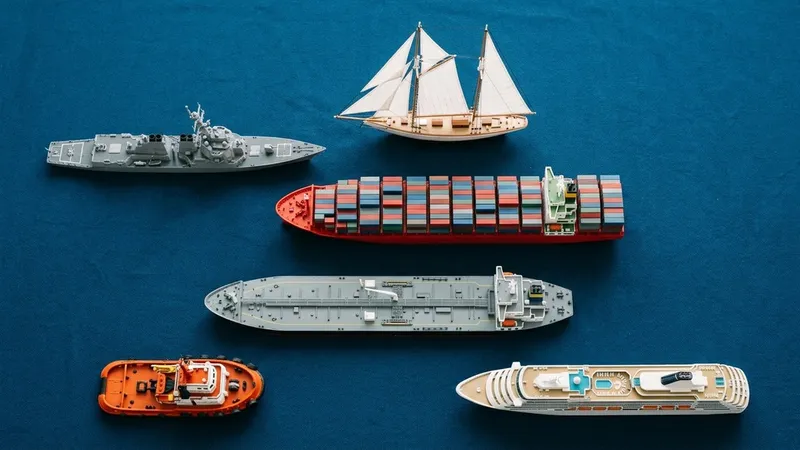
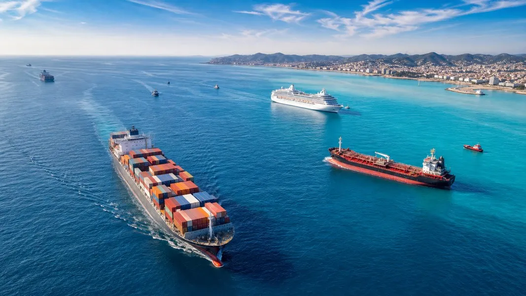
There are nine main types of ships you'll encounter on live vessel tracking maps: container ships, bulk carriers, tankers, cruise ships, naval vessels, LNG carriers, ferries, offshore support vessels, and sailing craft. Each one looks different, moves at a different speed, and shows up in different parts of the ocean.
Whether you're watching a cargo shipment cross the Pacific, tracking a cruise ship your family is on, or curious about the vessels clustered off a coastline, knowing what type of ship you're looking at changes everything. The AIS data on your screen tells you position and speed. The vessel type tells you the story behind it.
This guide covers all nine categories, including what makes each type distinctive on a map, where they tend to appear, and how tracking works differently for each.
Types of Ships: The 9 Main Categories
Before diving in, a quick note on AIS. Under the SOLAS convention, most commercial vessels above 300 gross tonnes on international voyages must carry Class A AIS transponders. That means container ships, bulk carriers, tankers, cruise liners, and ferries are almost always visible on tracking maps. Military vessels and small recreational craft are the main exceptions.
Here's what each category looks like on the water and on a live tracking app.
1. Container Ships
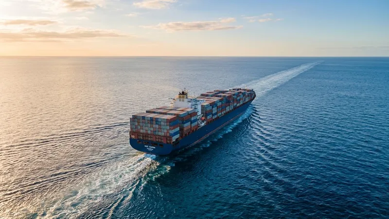
Container ships carry standardized boxes, measured in TEUs (twenty-foot equivalent units), on fixed liner schedules between major ports. The biggest ships today hold upward of 24,000 TEUs. The largest operators include Maersk, MSC, CMA CGM, and COSCO, which is why those names appear constantly when tracking cargo.
On a tracking map, container ships are usually shown as green icons, moving at 14 to 22 knots on ocean legs. They follow well-defined east-west corridors: Asia to Europe, Asia to North America, and a series of north-south routes connecting those trade regions to Africa, South America, and Oceania. You'll see them cluster near canal chokepoints like Suez and Panama, and queue outside major hub ports.
Visually, a container ship has a boxy profile with the bridge set far aft, and rows of containers stacked high on deck. When fully loaded, it sits low in the water with a visible waterline. When sailing in ballast (empty), it rides noticeably higher.
2. Bulk Carriers
Bulk carriers transport unpackaged dry commodities: iron ore, coal, grain, fertilizers, bauxite, and cement. They're the backbone of the steel, energy, and agriculture supply chains. The fleet is divided by size, from small Handysize vessels around 25,000 deadweight tonnes (DWT) up to enormous Valemax ore carriers at 380,000 to 400,000 DWT, used almost exclusively on the Brazil-to-China iron ore route.
Handysize and Supramax vessels often carry their own deck cranes, a key visual identifier because it means they can load and unload in ports without shore-based equipment. Capesize ships, at over 100,000 DWT, are too wide for the Panama Canal and route around Cape Horn or the Cape of Good Hope.
On a tracking map, bulk carriers tend to be slow-moving and follow long, point-to-point routes between a small number of specialized ports. A Capesize ship heading from Australia toward a Chinese steel mill is doing almost exactly what it always does, on almost exactly the same route.
3. Tankers
Tankers move liquid cargo: crude oil, refined petroleum products, and chemicals. The size ranges are wide. Medium Range (MR) product tankers carry gasoline and diesel around regional markets. Very Large Crude Carriers (VLCCs) hold up to two million barrels of crude oil on long-haul routes between the Arabian Gulf and refineries in Asia, Europe, or the Americas.
Crude tankers cluster around the world's major oil export terminals. The Arabian Gulf, Gulf of Mexico, and West African coast are the busiest tanker zones on any tracking map.
Most AIS platforms display tankers with red icons to distinguish them from standard cargo ships. The AIS vessel-type field typically reads "Oil/Chemical Tanker" or "Tanker", and the draught reading tells you whether a ship is loaded or empty. A VLCC fully laden sits at around 23 metres of draught; the same ship in ballast rides much higher.
Modern tankers use double-hull construction, placing two layers of steel between the cargo tanks and the sea. This design became mandatory under MARPOL regulations following major spill events in the 1990s.
4. Cruise Ships
Cruise ships are the largest passenger vessels on the water. Royal Caribbean, Carnival, MSC, and Norwegian operate the biggest fleets, with the largest ships carrying several thousand passengers and crew. What makes cruise ships stand out is their height: multiple decks of balconies and resort facilities rise well above the waterline, giving them a silhouette unlike anything else in the fleet.
All passenger ships must broadcast AIS regardless of size. That makes cruise ships some of the most consistently tracked vessels on the water. They operate on published itineraries, so the AIS destination and ETA fields actually correspond to a real port call at a known time.
Families use Primo Nautic to follow cruise ships on exactly these routes, checking live position, weather conditions at sea, and ETA for the next port. The app's AI adapts its updates depending on whether you're tracking a loved one traveling or just curious about a ship you spotted from shore.
On most maps, cruise ships appear as dark blue icons, moving at 16 to 22 knots at sea and slowing near ports. Their seasonal patterns are predictable: Caribbean in winter, Mediterranean and Northern Europe in summer.
5. Naval and Military Vessels
Types of naval ships include destroyers, frigates, aircraft carriers, corvettes, patrol boats, and amphibious assault ships. What sets military vessels apart on tracking maps is that most of them don't appear at all.
AIS regulations are designed for commercial shipping. Military vessels are generally exempt and typically don't broadcast continuously, because doing so would reveal operational movements. As covered in our post on military vessel tracking, naval ships do appear on AIS in specific circumstances: port visits, transits through congested straits, or exercises in areas with heavy civilian traffic.
When naval vessels do show up, they may be listed under "Military, Law Enforcement, or Other" vessel-type categories depending on how the transponder is configured. Their movement patterns don't follow the predictable commercial logic of container ships or tankers. You might see unusual patrol patterns or a vessel appearing briefly near a naval base before dropping off the map.
6. LNG Carriers
LNG carriers transport liquefied natural gas at around -162°C. They're a specialized type of gas tanker and among the more visually striking ships you'll find on a tracking map.
The most recognizable design is the Moss-type carrier, with large spherical tanks protruding above the main deck, giving the ship a distinctive bubble-top profile. Membrane-type carriers have flat-topped hulls with internal containment systems and look more like conventional tankers from above.
LNG carriers are fast, typically moving at 15 to 20 knots, because delivery timing matters in gas supply contracts. Key routes run from Qatar through the Strait of Hormuz to Europe and Asia, from the US Gulf Coast to European regasification terminals, and from Australia to East Asian import hubs. You'll see them queuing near major LNG terminals on both ends of those routes.
We've covered LNG in more detail in how LNG carriers work, including the containment systems and global trade routes they serve.
7. Ferries and Passenger Vessels
Ferries are short- to medium-range passenger and vehicle carriers. They serve island communities, cross-harbour routes, and coastal connections that lack road or rail alternatives. Ro-Pax ferries (roll-on/roll-off with passenger accommodation) can carry hundreds of vehicles and thousands of passengers. High-speed catamarans and hydrofoil ferries cover shorter routes where transit time matters most.
All passenger vessels must carry AIS, so ferries are among the most reliably visible ships on tracking maps, even at smaller sizes. You can identify ferries on a map by their movement pattern: they shuttle back and forth between the same two points on a tight schedule, forming a visible pendulum track.
Speed varies widely. A harbour ferry might cross at 10 knots. A high-speed catamaran on a coastal crossing can reach 35 knots or more. Tracking apps show the destination and scheduled arrival time, which ferry operators often input into their AIS voyage data fields, making it possible to match schedules with live positions.
8. Offshore Support Vessels
Offshore support vessels are the workhorses of the oil, gas, and offshore wind industries. Platform supply vessels (PSVs) resupply rigs and floating production units with equipment, fuel, food, and crew. Anchor handling tug supply (AHTS) vessels move and position drilling rigs. Crew transfer vessels shuttle personnel between shore and offshore platforms.
The visual signature of offshore support vessels on a tracking map is clustering. Offshore energy fields generate dozens of vessel movements in a compact area, particularly in the North Sea, Gulf of Mexico, offshore Brazil, and West Africa. If you see a cluster of slow-moving vessels in open water away from any port, there's usually an offshore field or wind farm development beneath them.
On most maps, offshore support vessels appear in teal or light blue. They typically move at 0 to 8 knots when working in a field, and slightly faster at 10 to 13 knots on transit legs back to shore bases.
9. Sailing Ships and Recreational Craft
Types of sailing ships range from traditional tall ships with multiple masts and complex historical rigging to modern ocean racing yachts and superyachts. Smaller recreational vessels make up the largest category of ships by count globally, though most carry only a Class B AIS transponder, or none at all.
The vessels that reliably appear on tracking maps include larger racing yachts during regattas, superyachts moving between Mediterranean and Caribbean seasons, and tall ships on festival circuits. Enthusiasts use Primo Nautic to track these vessels by name, following their position and speed as races unfold or notable yachts shift between ports.
Racing yachts produce distinctive patterns: tight, fast tracks along a course. Superyachts cluster near well-known anchorages. Tall ships move slowly and deliberately, often appearing near coastal cities during maritime heritage events. Smaller cruising sailboats, when equipped with AIS, show meandering coastal routes with overnight stops.
How Vessel Types Appear on Live Tracking Maps
Most AIS platforms use color-coded icons to separate vessel categories at a glance. According to the containerized trade data published by the World Shipping Council, container ships alone account for around 17 percent of global seaborne trade by value, yet they're just one of many vessel types visible on any live map.
The AIS vessel-type field gives you the specific category: "Container Ship", "Bulk Carrier", "Oil/Chemical Tanker", "Passenger (Cruise)", "Pleasure Craft", "Gas Carrier", and so on. Understanding these categories helps you interpret what you're seeing. A slow cluster in open ocean usually means vessels queuing outside a congested port, not a fleet sailing in formation. A single vessel making small circles is probably doing a survey or waiting at anchor. Fast blue icons near a Caribbean island chain are almost certainly cruise ships following a published itinerary.
Conclusion
The nine main types of ships each follow distinct patterns on the water. Container ships stream along trade corridors. Bulk carriers make slow, long-distance runs between mining regions and industrial ports. Tankers cluster around energy terminals. Cruise ships trace seasonal itineraries between leisure destinations. Naval vessels are mostly invisible by design. LNG carriers, ferries, offshore support vessels, and sailing craft each occupy their own characteristic zones on the map.
Recognizing these categories turns a live tracking map from a collection of moving icons into a readable picture of how global trade, energy, and travel move across the ocean.