




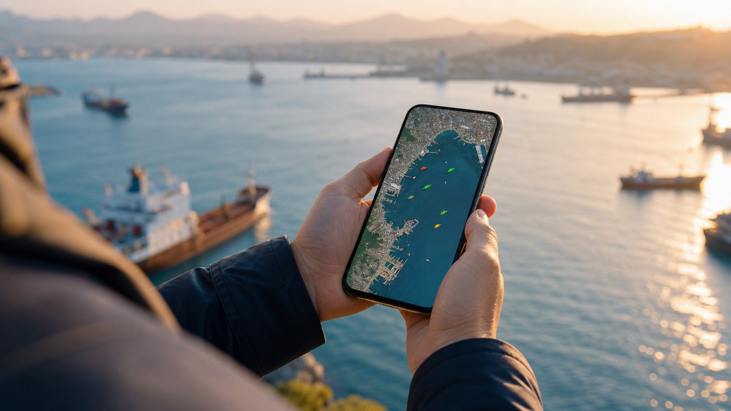
MarineTraffic Alternatives: Best Ship Tracker Apps
MarineTraffic is the standard reference for AIS vessel tracking data. If you work in maritime intelligence, run a fleet, or need deep historical archives, it is hard to beat. But for cruise families, seafarer loved ones, small cargo shippers, and ship enthusiasts, the platform can feel like a professional control room when all you need is a clear answer to one question: where is the ship and when will it arrive?
This guide covers the best MarineTraffic alternatives today, what each one is best at, and how to decide which one fits your situation.
Why People Look for MarineTraffic Alternatives
MarineTraffic earns its reputation through data depth and breadth. That said, specific users run into the same friction points repeatedly, and understanding them helps you pick the right replacement.
The interface is designed for professionals. MarineTraffic's web and mobile products feature layered filters, analytics panels, vessel tables, and advanced tools built for maritime analysts and OSINT researchers. One walkthrough describes it as a platform you learn step by step for serious shipping analysis, not one that guides casual users intuitively toward the information they need.
Free-tier ocean coverage is limited to coastal AIS reception. Terrestrial AIS receivers only reach ships near shorelines, so vessels crossing open oceans disappear from the map on the free plan. For families tracking a transatlantic cruise or shippers monitoring a container en route from Asia, that gap becomes a practical problem on a regular basis.
Personalization is absent. MarineTraffic structures its user experience around professional roles rather than tracking purposes. A cruise family, a seafarer's partner, and a small importer have distinct information needs, but the platform offers the same dense data feed to all of them. No guided workflow exists to show different users what is relevant to their specific situation.
The mobile app is marketed explicitly toward maritime professionals, emphasizing advanced alerts, fleet management, and zone monitoring. For users who simply want to follow a single vessel on a clean mobile map, that professional orientation adds friction rather than clarity.
Quick Comparison Table
| Tool | Best For | Free Access | Key Strength |
|---|---|---|---|
| Primo Nautic | Families, shippers, enthusiasts | Yes | AI-personalized insights, ETA predictions |
| VesselFinder | Individuals wanting clean AIS data | Yes (limited) | Strong terrestrial network, simple search |
| FleetMon | Fleet monitors, commercial users | Yes (limited) | Extensive vessel database, satellite option |
| CruiseMapper | Cruise passengers and families | Yes | Cruise-specific itineraries and deck plans |
| MyShipTracking | Basic position checking | Yes | Lightweight, straightforward free AIS map |
| Marine Vessel Traffic | Casual enthusiasts, coastal tracking | Yes | Simple interface, localized language support |
| Ship Tracker: Peta AIS | iOS users wanting a native experience | Yes | Smooth MapKit-based mobile UX |
Primo Nautic
Primo Nautic is an AI-powered vessel tracking app built for users who need more than a position on a map. Rather than presenting raw AIS data and leaving interpretation to you, Primo Nautic adapts what it shows based on why you are tracking the vessel.
The app uses six distinct tracking purposes: following a loved one on a cruise, supporting a seafarer working at sea, tracking a friend on a voyage, monitoring cargo shipments, keeping tabs on your own boat, or exploring vessels as an enthusiast. Each purpose activates a different communication style. A cruise family sees warm, journey-focused updates about the voyage and conditions. A cargo shipper receives precise logistics data focused on ETA and delay risk. The information is the same at the AIS level; the framing and emphasis change completely based on your relationship to the vessel.
The dual ETA system is one of the most useful features for cargo monitoring: it shows both the captain's reported arrival time and an AI-calculated estimate based on current route and speed, along with a confidence score. Delay detection is automatic, so you get notified when something changes rather than checking repeatedly yourself.
Live weather at the vessel's exact location adds practical context without requiring you to interpret raw sea state data. You see whether conditions are calm or rough at the ship's position in terms that make sense for your use case, whether you are a worried parent or a logistics coordinator.
Primo Nautic is available on iOS and Android. The free tier includes a monthly credit allowance that covers regular tracking for most individual users. If you want background on the technology, the explanation of how AIS tracking works is useful context before you start.
VesselFinder
VesselFinder is one of the most widely used vessel tracking apps and a natural first stop for anyone stepping away from MarineTraffic. Available on iOS and Android, it has built a solid terrestrial AIS network that covers ships near coastlines worldwide.
The interface is more accessible than MarineTraffic's for everyday use. Search by vessel name or identifier, view real-time position, speed, and heading, and get voyage details without configuring advanced filters first. The map is clean and navigable on mobile without needing to hide layers of professional-grade analytics.
VesselFinder is well suited for individuals who want reliable AIS positions and basic voyage data without excessive complexity. Satellite AIS coverage and extended historical track data are available at higher tiers, which bring the depth closer to MarineTraffic for users who need it.
The limitation in a family or cargo context is the same as with most AIS platforms: VesselFinder presents data rather than context. You see coordinates, speed, and destination, but you do not get AI-generated updates that translate those numbers into a meaningful narrative about the voyage. It serves users who are comfortable reading AIS output directly. For users who want the data interpreted for them, a tool with purpose-based personalization fills that gap better.
FleetMon
FleetMon combines a live AIS vessel tracking app with access to one of the larger open vessel databases available. The FleetMon mobile app lets you search for ships worldwide and view real-time positions, and the platform's "Unlimited Sat" subscription tier provides satellite AIS coverage for tracking ships outside coastal range.
The platform's roots are in commercial fleet monitoring and B2B data services, which shows in its product focus. Fleet management tools, API access, and data export features are prominent. For individual users who simply want to follow a vessel without enterprise needs, the broader platform may offer more than they need, but the mobile app provides a usable AIS viewer even if you only use a fraction of its capabilities.
FleetMon works best for users who already engage with fleet data professionally and want mobile access to the same platform they use at a desk. For families tracking one vessel or small importers monitoring a single shipment, the learning curve and enterprise orientation can make it feel heavier than necessary.
Like MarineTraffic and VesselFinder, FleetMon presents raw AIS data without personalizing the experience by tracking purpose. It is a capable data tool for users who know what they are looking for.
CruiseMapper
CruiseMapper is purpose-built for cruise ships and cruise ships only. That narrow focus makes it one of the most useful tools for cruise passengers and their families, and unnecessary for anyone tracking cargo or general commercial vessels.
The platform combines AIS-based vessel positions with published cruise itineraries, providing richer context than a raw AIS map alone. You can follow a ship's route through multiple ports, see scheduled arrival and departure times at each stop, browse deck plans, view cabin categories, and access ship photos and specification details. For a family member onshore waiting to hear that the ship has arrived at a particular port, the itinerary layer adds clarity that a generic AIS position cannot.
CruiseMapper's cruise-specific data makes it more informative than general AIS tools for passengers and families who want to understand the voyage, not just the current position. The trade-off is clear: it does nothing for cargo tracking, seafarer family monitoring, or any vessel outside the cruise fleet. Its value is entirely tied to the cruise context.
Web access is free for most features, with the app available on iOS and Android for on-the-go voyage following.
MyShipTracking
MyShipTracking offers straightforward AIS vessel tracking through a free web interface. You can search for ships by name or identifier, view their current position, speed, and heading, and check destination and estimated arrival data where the AIS feed provides it. Basic access does not require account creation, which keeps friction low for one-off position checks.
The platform sits at the lightweight end of the spectrum. It does not have the analytical depth of MarineTraffic or VesselFinder, but that simplicity works in its favor for users who need to check a vessel's position occasionally without installing an app or learning a complex interface. Mobile usability relies on a responsive web layout rather than a dedicated native app, which is worth noting if smooth on-device performance is a priority.
Satellite AIS and advanced data features require paid access, consistent with the model used across this category. For coastal and near-shore vessel checking with no commitment, MyShipTracking is a capable free option. It is not designed for active monitoring, delay alerts, or personalized updates.
Marine Vessel Traffic
Marine Vessel Traffic is a free, terrestrial AIS platform that covers the basics of ship position tracking without the complexity of professional-grade tools. A side-by-side comparison of major AIS platforms highlights its localized language support and simplified interface as accessible features for users in regions where it is actively maintained.
The coverage model is straightforward: coastal AIS reception only, with no satellite option. Historical track data is limited compared to VesselFinder and MarineTraffic. What the platform does well is present live ship positions in a clean, navigable map interface without requiring configuration or maritime knowledge to get started.
Marine Vessel Traffic suits ship enthusiasts who want to browse vessels in a port or along a familiar coastline without needing ocean-wide coverage, extended history, or any form of purpose-based tracking. It is a simple AIS viewer, clearly positioned as such.
Ship Tracker: Peta AIS
Ship Tracker: Peta AIS is a native iOS app designed specifically for users who want a mobile-first vessel tracking experience without a web-based wrapper. It uses Apple MapKit for map rendering, which gives it the smooth performance and visual integration that iOS users expect from native apps.
Search works by vessel name, IMO number, MMSI, callsign, or flag, with each result showing speed, direction, ETA, flag, and recent route context at a glance. Nearby ships and ports are surfaced without manual filtering, and a fleet list lets you save vessels you track regularly. NAVTEX notices and port event information add maritime context for enthusiasts who want more than just positions.
For iOS users who want a polished native experience over a browser-based AIS viewer, Peta AIS is one of the better-designed apps in this category. A Pro tier expands the workspace with additional fleet tools and maritime information. It does not offer the AI personalization or purpose-based communication of Primo Nautic, but it delivers a native mobile experience that many cross-platform tools do not match.
How to Choose the Right MarineTraffic Alternative
The right choice depends on what you actually need from vessel tracking, not on which platform has the most features overall.
If you are tracking a cruise for a family member, following a seafarer at sea, or monitoring cargo, the most important capabilities are clear ETAs, ocean-wide coverage, delay alerts, and updates that explain conditions in plain language. Primo Nautic is built for exactly this: purpose-based AI communication, dual ETA predictions, and live weather at the vessel's location. It translates AIS data into context that non-maritime users can act on without needing to interpret raw numbers themselves.
If you are comfortable reading raw AIS data and want reliable positions without personalization, VesselFinder is the most accessible starting point with a clean interface and strong free tier. For cruise passengers who want itinerary detail and deck-level context for their own voyage, CruiseMapper handles that with cruise-specific depth that no general AIS platform replicates.
Occasional position checking with no commitment or sign-up is best served by MyShipTracking or Marine Vessel Traffic. Commercial fleet professionals already using an enterprise tracking platform will find FleetMon the most natural mobile companion. iOS users who want a native app rather than a web wrapper should look at Peta AIS alongside Primo Nautic.
For a broader comparison across more tracking tools, the roundup of best AIS apps covers additional options organized by use case.
Conclusion
MarineTraffic is a powerful platform built for professional maritime data work. For families, seafarer loved ones, cargo shippers, and casual enthusiasts, it often provides more complexity than necessary and less guidance than helpful.
The alternatives above cover the full range of what most users need. Personalized, AI-driven tracking for families and shippers comes from Primo Nautic. Clean, reliable AIS positions come from VesselFinder. Cruise-specific itinerary context comes from CruiseMapper. Lightweight free access comes from MyShipTracking and Marine Vessel Traffic. A native iOS experience comes from Peta AIS.
Matching the tool to your actual reason for tracking a vessel makes the difference between a frustrating data exercise and a genuinely useful update about what is happening at sea.
Most Recent Posts
Discover more articles from our blog.