Holland America Cruise Ship Tracker: Best Apps
A Holland America ship tracker is what families and friends need when a loved one sets sail and the cruise line's own app falls short. Holland America's Navigator app is designed for passengers on board, covering onboard features like dining reservations and daily activity schedules. It does not offer a public live position feed for relatives following the voyage from home.
That leaves third-party AIS tracking apps as the practical solution, and several of them work exceptionally well for Holland America ships. This guide compares the best options, explains how each one works, and helps you decide which fits your situation.
Why Holland America Has No Public Ship Tracker
Holland America's consumer-facing digital tools focus on the onboard experience. The Navigator app manages shore excursion bookings, daily itineraries, and dining, all tailored for passengers who are already on the ship. There is no public-facing position map, no shore-side ETA tracker, and no family access feature.
The Holland America website is similarly focused on bookings and itinerary browsing rather than live vessel positions. Port schedules sometimes list expected arrival windows, but those are static timetables, not continuous tracking.
This is not unusual among cruise lines. Most major carriers treat ship tracking as an internal operational tool rather than a consumer feature. The gap is filled reliably by independent AIS-based apps that source position data directly from the ships themselves, not from the cruise line's systems.
How AIS Ship Tracking Works
Every large commercial vessel, including every ship in the Holland America fleet, broadcasts its position automatically using the Automatic Identification System. The signal transmits the ship's GPS coordinates, speed, course, and navigation status on a continuous basis.
Shore-based AIS receivers along coastlines pick up these signals and relay them to tracking platforms, typically within seconds. When a ship moves into open ocean beyond receiver range, satellite AIS extends coverage to areas where terrestrial networks cannot reach. Update frequency may be slightly lower at sea, but position data remains available throughout most ocean crossings.
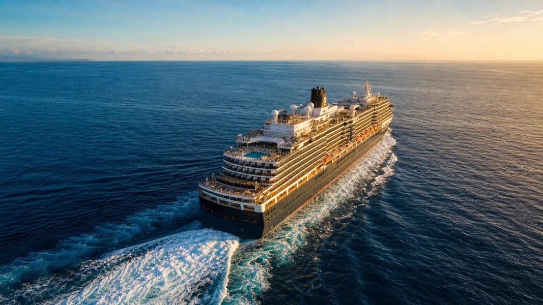
The practical result for families is that near coasts, in port approaches, and along popular cruise routes, Holland America ships appear on AIS-based trackers with near real-time accuracy. You can watch the Rotterdam move between Caribbean ports, follow the Koningsdam through the Inside Passage in Alaska, or track the Nieuw Statendam as it works its way along the Norwegian fjords.
AIS data includes not just position but also speed and course, which apps use to generate ETA predictions. If the ship is running ahead of schedule or dealing with headwinds, a tracker that processes this data can give you a more accurate arrival estimate than the static itinerary.
Best Apps to Track Holland America Ships
The four apps below all use AIS as their data source. What differs is how much context, personalization, and automation each one builds on top of the raw position signal.
| App | Best For | Key Feature | Free Access |
|---|---|---|---|
| Primo Nautic | Families wanting AI-powered insights | Personalized updates + dual ETA | Yes (credits) |
| MarineTraffic | Detailed AIS data and track history | Large receiver network | Limited |
| VesselFinder | Quick position checks | Clean, simple map | Yes |
| CruiseMapper | Cruise itinerary context | Schedule integration | Yes |
Primo Nautic
Primo Nautic is an AI-powered vessel tracking app that transforms raw AIS data into human-friendly updates. When you track a Holland America ship, you are not watching a dot on a map; you get context about where the ship is in its voyage, what conditions are like at sea, and when it is expected at the next port.
The app's most useful feature for families is its personalized tracking mode. You choose your reason for tracking: following a loved one on a cruise, monitoring a friend traveling, or tracking your own vessel. Primo Nautic adapts its tone and focus accordingly. A family following a cruise receives warm, reassuring updates about voyage progress rather than raw nautical data fields.
The dual ETA system compares the captain's reported arrival time against an AI-calculated prediction based on the ship's current speed, course, and historical arrival patterns at each port. When a delay is developing, the app detects it early and sends a notification. For families planning when to expect calls or messages from port, that kind of advance notice is genuinely useful.
Primo Nautic also surfaces live weather at the ship's exact location. If conditions are rough off the coast of Nova Scotia on a transatlantic crossing, or calm through the Caribbean on a seven-night itinerary, you see that context alongside the position data. Arrival and departure alerts mean you can set up tracking once and receive updates passively, without opening the app at regular intervals.
The app is available on iOS and Android and uses a credit system with a free tier that supports around 30 vessels per month.
MarineTraffic
MarineTraffic is one of the most widely used AIS platforms globally and a standard recommendation in cruise communities for tracking ship progress. You search by vessel name (Rotterdam, Koningsdam, Zaandam, Nieuw Statendam) and pull up the live position on an interactive global map.
The platform's core strength is its AIS receiver network, which spans thousands of stations worldwide. Coverage is strong across all the major Holland America sailing regions: the Caribbean, the Mediterranean, Alaska, Northern Europe, and the Baltic. Satellite AIS is available on higher-tier plans for open-ocean tracking.
For families, MarineTraffic works best for looking up a ship's position and checking its recent movement. Track history shows the last few days of sailing, so you can see which ports the ship has already visited and confirm it is following its planned route. Port arrival and departure data is reliably logged.
The interface is more technically oriented than some family users prefer. Speed is shown in knots, course in degrees, and navigation status uses maritime terminology. For users comfortable reading a nautical map, it is a powerful tool. For those who want plain language summaries, there is a learning curve.
You can explore other options in our MarineTraffic alternatives guide if you find the interface more technical than you need.
VesselFinder
VesselFinder offers a clean, accessible vessel tracking interface for real-time ship positions. It pulls live AIS data for all vessel classes, including the full Holland America fleet. Search by ship name, find the vessel on the map, and see its current position, speed, and next scheduled port.
The free version provides enough functionality for casual checking. You can confirm whether the Rotterdam is at sea or in port, see roughly how far it is from its next destination, and check when it is expected to arrive. There are no AI-generated summaries or personalized notifications in the free tier, but the map view is clear and quick to navigate.
VesselFinder suits families who want a no-setup tracker they can check occasionally. If you already know the itinerary and just want to verify the ship's current position between ports, it delivers that efficiently. For more automated, notification-driven tracking, you will likely want an app with alert functionality built in.
CruiseMapper
CruiseMapper focuses specifically on cruise ships, combining AIS position data with cruise-specific context that general maritime trackers do not include. It shows live vessel positions alongside itinerary schedules, so you can see both where the ship is now and how that fits into the planned voyage.
The platform includes ship profiles covering passenger capacity, deck plans, and interior details, which gives families a clearer sense of the vessel their loved one is traveling on. Upcoming port calls are displayed in itinerary order with expected arrival times derived from AIS data and schedule integration.
For families following a Holland America cruise day by day and wanting to understand where each port fits in the overall journey, CruiseMapper adds useful framing. The experience is tailored to cruise voyages rather than the broader maritime world, so the map is not cluttered with cargo ships and tankers alongside the cruise fleet.
What to Look for in a Holland America Ship Tracker
When evaluating tracking apps for a cruise voyage, a few features consistently matter most for shore-side family use.
Real-time position accuracy is the starting point. You want position data that reflects where the ship actually is, not a feed that lags by hours. Near major ports and coastlines, AIS updates come through frequently. For ocean segments, satellite AIS coverage makes the difference between a useful tracker and an intermittent one.
ETA predictions tell you when the ship will reach its next port. Static itinerary times can shift by hours depending on weather, sea conditions, and port traffic. An app that processes live AIS data to generate dynamic ETAs is significantly more useful than one that just displays the original schedule.
Weather context at the ship's location adds meaning to position data. If the ship is in rough seas north of Iceland or calm waters in the Bahamas, that information shapes how you interpret what you are seeing on the map. Apps that layer weather conditions directly onto tracking make it easier to stay informed without checking multiple sources separately.
Push notifications remove the need to remember to check the app. Arrival and departure alerts, delay notifications, and route deviation warnings keep you informed passively. You set up the tracking once and receive updates at each meaningful point in the voyage.
Ease of use matters for families who are not regular maritime users. An app that presents position, ETA, and weather in plain language is more practical day-to-day than one that surfaces raw nautical data requiring interpretation. For a broader comparison of available tools, see our guide to the best AIS apps across all vessel categories.
Holland America Itineraries Where Tracking Is Most Rewarding
Some Holland America routes lend themselves especially well to live tracking, either because of dense port schedules, scenic geography, or strong AIS coverage throughout.
Caribbean itineraries from Fort Lauderdale visit multiple ports in quick succession: Half Moon Cay, Grand Cayman, Roatan, Cozumel, and Belize City are common stops. Frequent port calls mean the ship is almost always either approaching, docked, or departing, and AIS coverage across the Caribbean is excellent. Tracking a Caribbean cruise provides daily updates on ship movement with minimal gaps.
Alaska itineraries take Holland America ships through some of the most visually striking waterways in the world. The Inside Passage from Vancouver to Seward passes through narrow channels, past glaciers, and into ports like Juneau, Ketchikan, and Sitka. AIS coverage is strong throughout this coastal route, and the combination of dramatic geography and frequent position updates makes tracking particularly engaging for families following from home.
European and Northern Europe itineraries visit ports across the Norwegian coast, Baltic capitals, and British Isles. Ships like Rotterdam call at Oslo, Copenhagen, Tallinn, Stockholm, Helsinki, and Reykjavik, among others. AIS receiver coverage is dense throughout European waters, and the density of port calls provides regular confirmation that the voyage is proceeding as planned.
Transatlantic crossings and longer world-style voyages are where satellite AIS matters most. Days at sea between continents mean the ship is out of terrestrial receiver range for extended stretches. Apps that include satellite coverage keep families informed during these ocean segments rather than showing a stale position until the ship approaches the next landfall.
Choosing the Right App for Your Situation
The best option depends on how you want to use it and how much context you want beyond a map position.
If you want to set up tracking once and receive updates automatically at each port, Primo Nautic matches the way most families naturally prefer to stay informed. The AI-generated context, personalized tone, and proactive alerts reduce the need to actively interpret what you are seeing. You do not need to know what a knot is or read a course bearing to understand where the ship is and how conditions are at sea.
If you want detailed AIS data and a comprehensive track history, MarineTraffic provides the deepest coverage and the most complete position record. It suits users who are comfortable with maritime data and want thorough information rather than simplified summaries.
If you want occasional position checks without notifications or accounts, VesselFinder gives you quick access to live ship positions with minimal setup. It is well-suited to checking in once a day rather than following the voyage closely.
If you want to follow the cruise as a structured journey with port-by-port context, CruiseMapper integrates itinerary and schedule information in a way that is specific to cruise travel.
Conclusion
Holland America does not provide a public ship tracker for families at home. The Navigator app serves passengers on board, not relatives following the voyage from shore. Third-party AIS apps fill that gap reliably across all Holland America itineraries.
The four apps in this guide each take a different approach to the same underlying data. Raw AIS position is available on all of them. What distinguishes them is how much they translate that data into something useful for people whose main concern is staying connected to a loved one at sea, not interpreting maritime navigation data. For families who want to feel genuinely informed rather than just technically updated, an app that adds context, predictions, and plain-language summaries around the position feed is the most practical choice.
Most Recent Posts
Discover more articles from our blog.