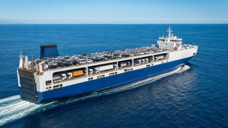

Yang Ming tracking through the carrier's official portal gives you container milestones and scheduled ETAs. What it doesn't give you is where the ship is right now, how fast it's moving, or whether your cargo will actually arrive when the schedule says. The apps in this guide fill that gap.
Yang Ming Marine Transport Corporation is a major Taiwanese container line headquartered in Keelung, operating global services across Asia, Europe, and North America. Like every major carrier, Yang Ming provides a container tracking system where you can look up status by container number, booking number, or bill of lading. It records the events that matter for documentation: loaded, departed, arrived, discharged. And it publishes scheduled ETD and ETA for each port.
That's useful as far as it goes. But for cargo monitors and import teams who need to act ahead of problems, milestone data alone isn't enough. This guide covers the three best tools to layer on top of Yang Ming's portal, and what each one does that the carrier can't.
What Yang Ming's Portal Shows and Where It Falls Short
Yang Ming's tracking system gives you event-based visibility. Search by container number, B/L, or booking, and you'll see the vessel name carrying your shipment, key status milestones, and the scheduled ETD and ETA at each port in the rotation. The data comes from Yang Ming's internal systems and terminal messaging, and it's accurate for what it records.
The limitation is what happens between events. Once a vessel departs, the portal shows you the next scheduled port and ETA. It does not show where the ship is right now, what speed it's making, or whether anything has changed at sea. For a trans-Pacific voyage, that gap runs two to three weeks.
Yang Ming's ETA is also schedule-based: it assumes planned speed and port conditions stay constant. When weather, port congestion, or an operational change slows a vessel, that ETA only updates after someone manually adjusts the internal schedule. The lag between what's actually happening at sea and what the portal shows can be hours or days.
Real-time AIS tracking fills the gap. AIS (Automatic Identification System) is a maritime positioning standard that broadcasts each ship's identity, position, speed, course, and navigation status. Terrestrial receivers cover coastal zones; satellite AIS captures vessels mid-ocean. Commercial platforms combine both feeds for position updates every few minutes across any Yang Ming vessel on any lane.
Our Top Picks at a Glance
| Rank | Tool | Best For | Key Feature |
|---|---|---|---|
| 1 | Primo Nautic | Cargo monitors needing delay alerts | AI-powered dual ETA and proactive notifications |
| 2 | MarineTraffic | Teams wanting historical route data | Full voyage replay and port congestion data |
| 3 | VesselFinder | Quick vessel lookups without complexity | Clean real-time map with basic port events |
How We Evaluated These Tools
Four criteria drove the evaluation:
- Live vessel position: Does the tool show the ship's current location, speed, and navigation status, not just scheduled milestones from the carrier?
- Dynamic ETA: Does it recalculate arrival time based on real vessel movement rather than Yang Ming's static schedule?
- Delay alerts: Does it notify you proactively when something changes, or do you have to check manually?
- Usability for non-maritime teams: Can a cargo monitor or import coordinator get actionable information without a maritime operations background?
#1 Primo Nautic
Primo Nautic is the strongest choice for cargo monitors tracking Yang Ming shipments. The app is built around the gap that carrier portals leave: everything that happens between port milestones.
To track a Yang Ming vessel, find the vessel name in the Yang Ming portal, then search for it in Primo Nautic. The app pulls live AIS data from a combined terrestrial and satellite network, showing the ship's current position, speed over ground, course, and navigation status updated continuously.
Dual ETA and Delay Alerts
The feature that separates Primo Nautic from basic AIS apps is its dual ETA system. Yang Ming publishes a schedule-based ETA. Primo Nautic calculates a parallel ETA from the vessel's actual AIS position, speed, historical lane performance, and port congestion data. When the two ETAs agree, you can plan confidently. When they diverge, that divergence is surfaced as an early warning.
In practice, this means catching a delay 4 or 5 days before Yang Ming's portal catches up. If a trans-Pacific Yang Ming vessel drops from 18 knots to 11 knots due to weather, the AIS-based ETA shifts immediately. You can reschedule drayage, adjust warehouse receiving windows, and notify downstream teams before the issue compounds.
Primo Nautic also sends proactive delay alerts when the predictive ETA moves beyond a set threshold, or when AIS data signals a significant change: extended anchorage near a congested port, a course deviation, or a sustained speed drop. You don't have to monitor the map yourself; the app notifies you when the situation warrants action.
AI-Powered Context
The AI layer adds context to what the raw data signals. Rather than leaving you to interpret speed and position changes, Primo Nautic explains the likely cause: weather slowdown, port queue, route adjustment. For teams without maritime backgrounds, that context turns AIS data into something actionable rather than just a dot on a map.
If you're tracking Yang Ming containers alongside shipments on Maersk or other carriers, Primo Nautic covers any AIS-broadcasting vessel globally from the same app, with consistent AI-generated insights regardless of which line the cargo is on. That cross-carrier scope matters as your shipment book grows.
Primo Nautic is available on iOS and Android.
#2 MarineTraffic
MarineTraffic is the most widely used AIS platform and a solid complement to Yang Ming's portal for teams that want detailed maritime data and historical context.
Once you have the vessel name from Yang Ming's tracking page, searching in MarineTraffic gives you the ship's live position on an interactive map, current speed, course, and expected port arrival. MarineTraffic aggregates feeds from an extensive global network of terrestrial receivers and satellite AIS, giving reliable coverage across both coastal segments and mid-ocean legs.
The historical voyage replay is where MarineTraffic particularly stands out. You can review a vessel's track over time, examine past port calls, and see how frequently specific Yang Ming services have arrived on schedule versus delayed. For teams moving cargo on the same lanes repeatedly, that historical performance data is valuable context for planning lead times and customer commitments.
MarineTraffic also surfaces port congestion signals. You can see how many vessels are waiting at anchorage near major ports like Rotterdam, Los Angeles, or Singapore, which provides independent context when Yang Ming's ETA looks optimistic given known terminal conditions.
The tradeoff: MarineTraffic is data-rich in a way that rewards users comfortable with maritime data. Finding ETA divergence from the carrier schedule requires manual comparison rather than automated alerts. For operations teams who want to be notified when something goes wrong rather than discovering it on a map check, that's a meaningful difference from Primo Nautic.
A free tier covers basic live positions with some data limitations. Faster refresh rates, extended historical data, and analytics sit in paid tiers.
#3 VesselFinder
VesselFinder covers the core use case cleanly: real-time vessel lookup with a straightforward interface. Search a Yang Ming vessel by name, and you'll see its current position, speed, course, heading indicator, and destination on a live map.
The platform runs on the same AIS principle as MarineTraffic but with a cleaner, less data-heavy layout. Port call information, arrival and departure events, and basic historical tracks are included. For cargo monitors who check in on a Yang Ming vessel a few times per voyage and don't need automated alerts, VesselFinder works reliably.
It's a practical reference point to cross-check against Yang Ming's ETA. If the vessel is moving at a strong pace with no unusual behavior, the carrier ETA is probably solid. If VesselFinder shows a slow speed or anchorage status near a busy port, that's a signal worth noting before the carrier portal catches up.
Like MarineTraffic, VesselFinder's free access covers the basics. Teams that need more depth, including API integrations or richer analytics, will find those features sit in paid plans.
For teams managing Hapag-Lloyd cargo tracking or other carriers alongside Yang Ming, both MarineTraffic and VesselFinder require separate manual checks per carrier. There's no automated exception management across a multi-carrier shipment book without something like Primo Nautic's alert system sitting on top.
What to Look for in a Yang Ming Tracking Tool
The right tool depends on what your team actually needs from visibility.
Automated alerts matter most for high-value and time-sensitive cargo. If a delayed Yang Ming container triggers production gaps, out-of-stocks, or missed customer commitments, a tool that finds you when something changes is worth more than one you have to monitor. Primo Nautic's delay alerts and dual ETA divergence notifications address this directly.
Historical data and manual analysis suit teams with maritime context. If you're moving cargo on recurring Yang Ming lanes and want to understand how those services typically perform, or if you have ops staff who can read AIS data confidently, MarineTraffic's historical voyage data and port congestion signals add real value.
Simple lookups fit occasional monitoring needs. If your tracking is infrequent, VesselFinder's free tier gives you a clean, reliable vessel position without overhead.
Multi-carrier scope matters at scale. Any of the three tools here tracks any Yang Ming vessel alongside vessels from every other major line. But only Primo Nautic automates the exception monitoring across all of them without manual map checks per shipment.
Conclusion
Yang Ming's official portal is the right foundation for container tracking: it gives you milestones, B/L data, and the scheduled ETA that define the baseline for any shipment. The gap is live vessel position, dynamic ETA recalculation, and proactive delay alerts.
Primo Nautic's dual ETA and AI-powered delay alerts make it the strongest choice for cargo monitors who need early warning on Yang Ming shipments. MarineTraffic suits teams that want historical lane performance and comprehensive AIS data for manual analysis. VesselFinder works well for straightforward vessel lookups without complexity.
Layering any of these tools on top of Yang Ming's portal means you're no longer flying blind during the ocean leg. You have both the authoritative milestone record and the real-time signals to catch problems before they hit your schedule.